Chule
| Site Name: | Chule | 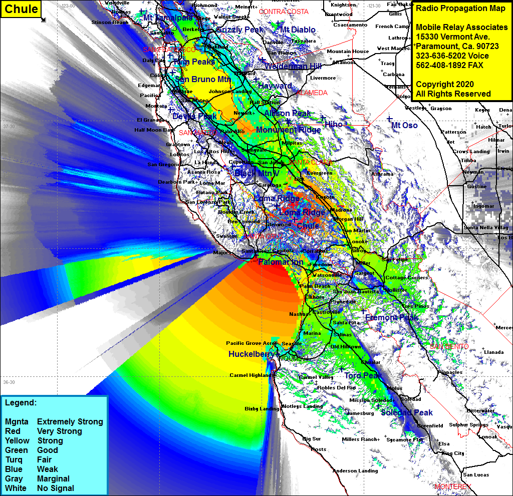 Chule Coverage |
| Latitude: | 037 06 49.3N | 37.1136944 |
| Longitude: | 121 50 10.3W | -121.8361944 |
| Feet | Meters | |
| Ground Elevation: | 3611.0 | 1100.6 |
| HAAT: | 2461.7 | 750.3 |
| City: | Los Gatos | |
| County: | Santa Clara | |
| State: | California |
This is not an MRA Owned Site. For space rental contact the site owner.
Do you own or manage this site? Click Here
Would you like to add a site to the Google Earth Map?? Click Here
Site Coverage: Coverage of the Monterey Bay area, Pacific Grove, Salinas, Spreckels, Chualar, Soledad, Greenfield, Tres Pinos, Cottage Corners, Dunneville, Gilroy, San Martin, Morgan Hill, Perry, Coyote, Alamitos, the San Francisco Bay area, the south bay, east bay north to Richmond, west bay including Menlo Park, Palo Alto, San Carlos, Belmont, Hillsdale, San Mateo, Foster City, Burlingame, Millbrae, San Bruno, South San Francisco, Bayshore, Lomita Park