Cisco Butte
| Site Name: | Cisco Butte | 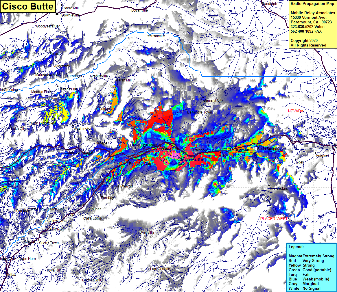 Cisco Butte Coverage |
| Latitude: | 039 18 20.8N | 39.3057778 |
| Longitude: | 120 33 45.8W | -120.5627222 |
| Feet | Meters | |
| Ground Elevation: | 6436.0 | 1961.7 |
| HAAT: | 606.4 | 184.8 |
| City: | Yuba Pass | |
| County: | Placer | |
| State: | California |
This is not an MRA Owned Site. For space rental contact the site owner.
Do you own or manage this site? Click Here
Would you like to add a site to the Google Earth Map?? Click Here
Site Coverage: Coverage of the northern edge of Placer County along Interstate 80 west of Lake Tahoe, Rainbow, Troy, Kingvale, Soda Springs, Gateway, Cisco Grove, Yuba Pass, Camp Spaulding, Emigrant Gap, Omega, Forebay, Midas, Gold Run, Junction House, Grass Valley, Boston Ravine, Newtown, Dantoni, Yuba City, Oswald, Abbott, Wilson, Millers Landing, Hinsdale, Progress, Josephine, Lira, Sycamore, Tierra Buena, Marysville, Lomo, Live Oak, Princeton, Afton, Butte City, Glenn, WIllows, Delevan, Sidds Landing, Rocavele, McIntosh Landing, Greenwood