Clay Jones Building
| Site Name: | Clay Jones Building | 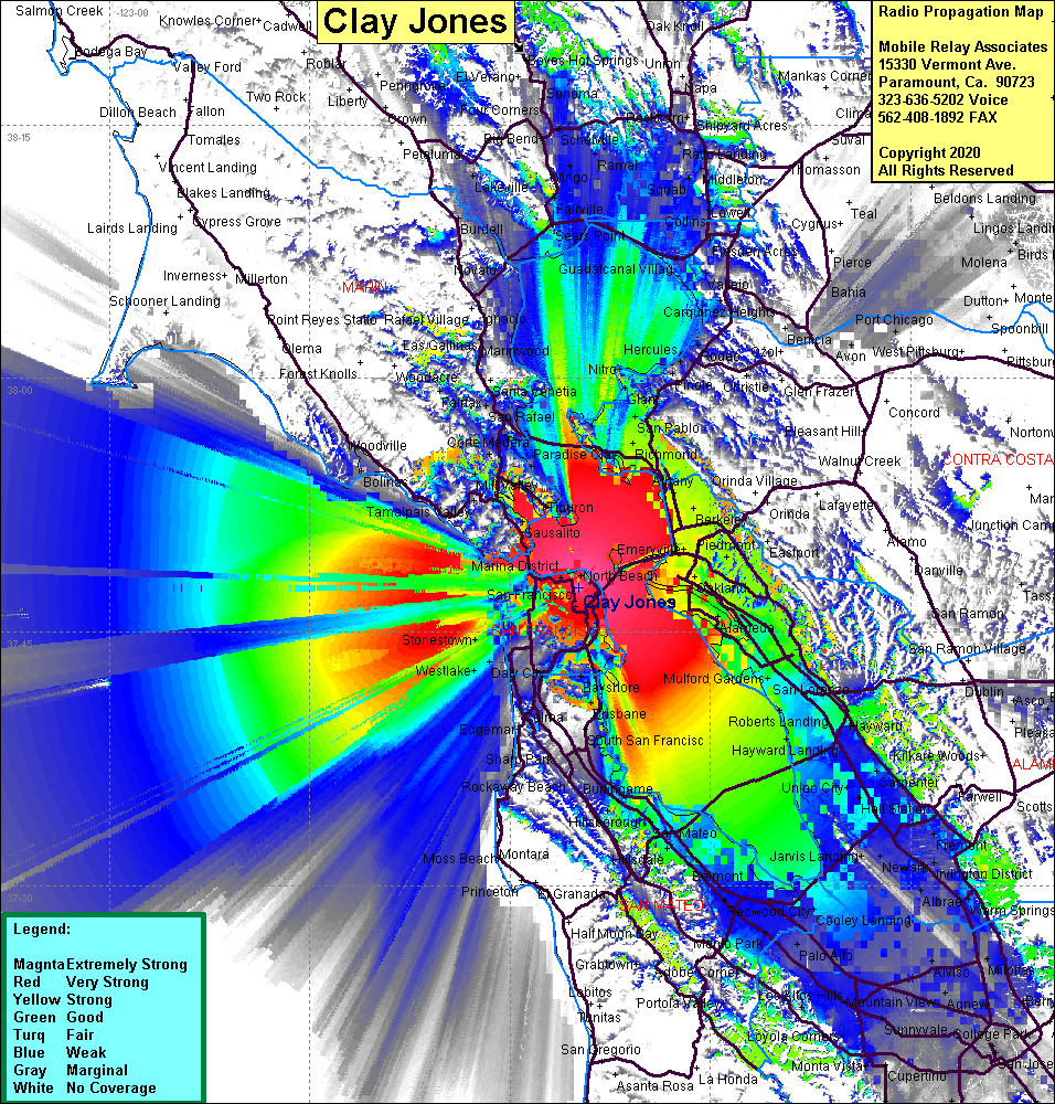 Clay Jones Building Coverage |
| Latitude: | 037 47 36.2N | 37.7933889 |
| Longitude: | 122 24 51.0W | -122.4141667 |
| Feet | Meters | |
| Ground Elevation: | 335.0 | 102.1 |
| HAAT: | 411.8 | 125.5 |
| City: | San Francisco | |
| County: | San Francisco | |
| State: | California |
This is not an MRA Owned Site. For space rental contact the site owner.
Do you own or manage this site? Click Here
Would you like to add a site to the Google Earth Map?? Click Here
Site Coverage: Coverage of San Francisco, Sausalito, Belvedere, Ft Mc Dowell, Mill Valley, Waldo, Alameda, San Leandron, San Lorenzo, Hayward, Berkeley, Albany, Richmond, San Pablo