Clayton Hill
| Site Name: | Clayton Hill | 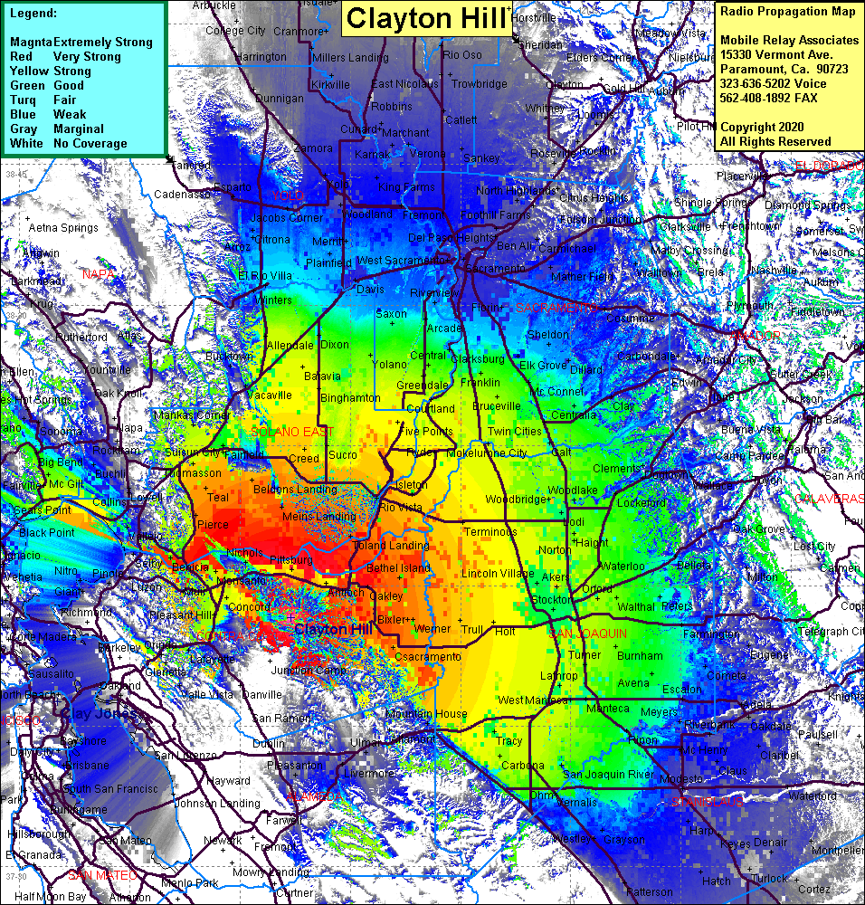 Clayton Hill Coverage |
| Latitude: | 037 56 33.7N | 37.9426944 |
| Longitude: | 121 53 06.8W | -121.8852222 |
| Feet | Meters | |
| Ground Elevation: | 1875.0 | 571.5 |
| HAAT: | 1356.7 | 413.5 |
| City: | Clayton | |
| County: | Contra Costa | |
| State: | California |
This is not an MRA Owned Site. For space rental contact the site owner.
Do you own or manage this site? Click Here
Would you like to add a site to the Google Earth Map?? Click Here
Site Coverage: Coverage of Concord, Pleasant hill, Four Corners, Monsanto, Avon, Benicia, Port Costa, Vine Hill, Clyde, Ozol, Eckley, Guadacanal Village, Vallejo, Wingo, Black Point, San Joaquin Valley south to Turlock and north to Yuba City