Coso Peak
| Site Name: | Coso Peak | 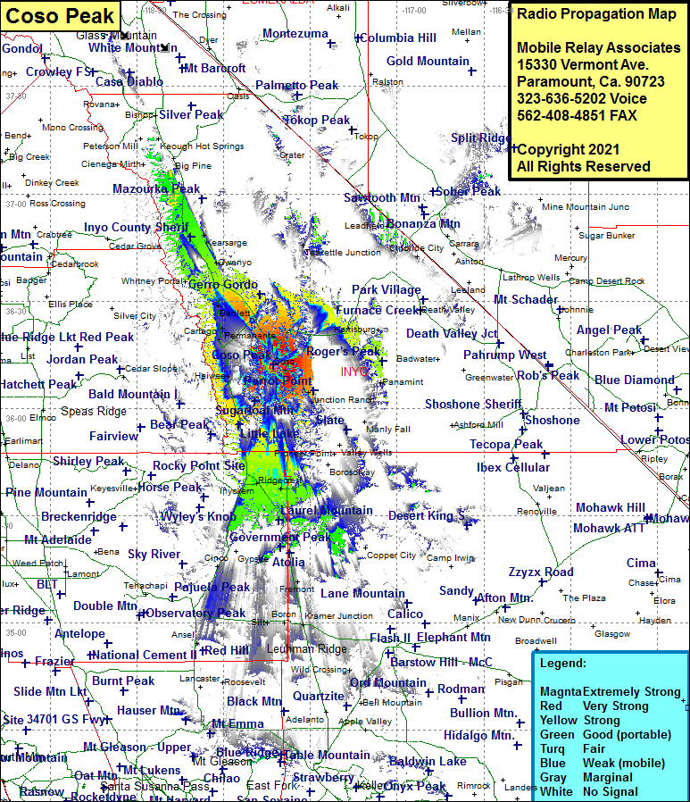 Coso Peak Coverage |
| Latitude: | 036 12 10.7N | 36.2029722 |
| Longitude: | 117 42 49.1W | -117.7136389 |
| Feet | Meters | |
| Ground Elevation: | 8159.0 | 2486.9 |
| HAAT: | 2368.8 | 722.0 |
| City: | Coso | |
| County: | Inyo | |
| State: | California |
This is not an MRA Owned Site. For space rental contact the site owner.
Do you own or manage this site? Click Here
Would you like to add a site to the Google Earth Map?? Click Here
Site Coverage: Coverage of Coso, Junction Ranch, Lane Mill, Darwin Mines, Panamint Springs, Olancha, Cartago, Permanente, Bartlett, Swansee, Lone Pine, Manzanar, Owenyo, Seven Pines, Kearnsarge, Seven Pines, Dumnovin, Linnie, Brown, Indian Wells, Inyokern, China Lake, Ridgecrest, Searles, Skidoo, Armistead, Freeman Junction, Gypsite, Cinco, California City, Aerial Acres, Fremont