Cottonwood
| Site Name: | Cottonwood | 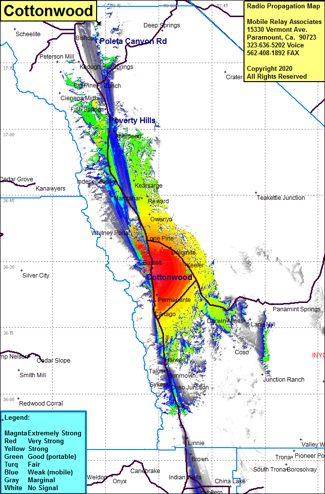 Cottonwood Coverage |
| Latitude: | 036 27 54.3N | 36.4650833 |
| Longitude: | 118 04 09.4W | -118.0692778 |
| Feet | Meters | |
| Ground Elevation: | 6045.0 | 1842.5 |
| HAAT: | 99.8 | 30.4 |
| City: | Lone Pine | |
| County: | Inyo | |
| State: | California |
This is not an MRA Owned Site. For space rental contact the site owner.
Do you own or manage this site? Click Here
Would you like to add a site to the Google Earth Map?? Click Here
Site Coverage: Coverage of the Owens Valley from Searles in the south to Bishop in the north including Indian Wells, Brown, Linnie, Bartlett, Lone Pine, Dolomite, Darwin Mines, Owenyo, Manzanar, Kearsarge, Independence, Aberdeen, Big Pine, Laws