Cummings Peak
| Site Name: | Cummings Peak | 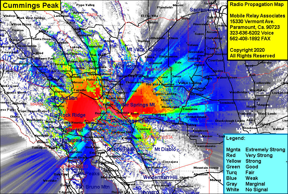 Cummings Peak Coverage |
| Latitude: | 038 01 43.7N | 38.0288056 |
| Longitude: | 122 11 50.9W | -122.1974722 |
| Feet | Meters | |
| Ground Elevation: | 899.0 | 274.0 |
| HAAT: | 709.9 | 216.4 |
| City: | Martinez | |
| County: | Contra Costa | |
| State: | California |
This is not an MRA Owned Site. For space rental contact the site owner.
Do you own or manage this site? Click Here
Would you like to add a site to the Google Earth Map?? Click Here
Site Coverage: Coverage of the San Francisco Bay area, specifically the north bay including Richmond, N Richmond, NcNears Beach, San Quentin, El Campo, Ft McDowell, Las Galinas, Marinwood, Burdell, Sears Point, Ignacio, Black Point, Fairville, McGill, Wingo, Merazo, Buchli, Dultin Landing, Stanley, Union, Salvador, Oak Knoll, Four Corners, Schelville, Big Bend, Ramal, El Verano, Port Chicago, Monsanto, Avon, Concord, Pleasant Hill, Bancroft, Walnut Creek, Clayton, Spoonbill, Collinsville, Monetzuma, Beldons Landing, Creed, Sucro, Dosier, San Joaquin Valley from Stockton in the south to Sacramento in the north