Deadwood
| Site Name: | Deadwood | 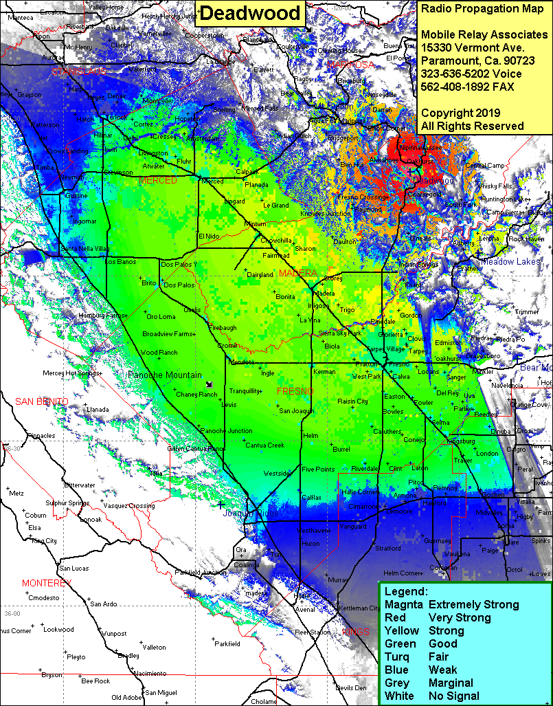 Deadwood Coverage |
| Latitude: | 037 18 48.8N | 37.3135556 |
| Longitude: | 119 41 10.5W | -119.6862500 |
| Feet | Meters | |
| Ground Elevation: | 4,521.0 | 1,378.0 |
| HAAT: | 1,853.4 | 564.9 |
| City: | Oakhurst | |
| County: | Madera | |
| State: | California |
This is not an MRA Owned Site. For space rental contact the site owner.
Do you own or manage this site? Click Here
Would you like to add a site to the Google Earth Map?? Click Here
Site Coverage: Coverage of the San Joaquin Valley, south to Allensworth, north to Harp, Oakhurst, Sugar Pine, Fish Camp, Elliott Corner, Mariposa