Devils Peak
| Site Name: | Devils Peak | 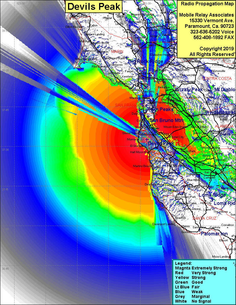 Devils Peak Coverage |
| Latitude: | 037 32 35.1N | 37.5430833 |
| Longitude: | 122 26 47.5W | -122.4465278 |
| Feet | Meters | |
| Ground Elevation: | 1,857.9 | 566.3 |
| HAAT: | 1,576.5 | 480.5 |
| City: | Burlingame | |
| County: | San Mateo | |
| State: | California |
This is not an MRA Owned Site. For space rental contact the site owner.
Do you own or manage this site? Click Here
Would you like to add a site to the Google Earth Map?? Click Here
Site Coverage: Coverage of the San Francisco Bay area, south to Robertsville, north to San Pablo, Half Moon Bay, Princton, Montara