El Dorado
| Site Name: | El Dorado | 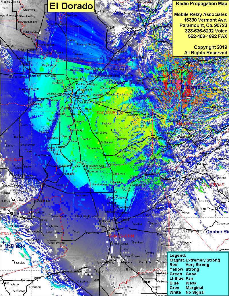 El Dorado Coverage |
| Latitude: | 038 37 50.2N | 38.6306111 |
| Longitude: | 120 51 25.0W | -120.8569444 |
| Feet | Meters | |
| Ground Elevation: | 1,939.0 | 591.0 |
| HAAT: | 618.8 | 188.6 |
| City: | Placerville | |
| County: | El Dorado | |
| State: | California |
This is not an MRA Owned Site. For space rental contact the site owner.
Do you own or manage this site? Click Here
Would you like to add a site to the Google Earth Map?? Click Here
Site Coverage: Coverage of the San Joaquin Valley, south to Manteca, North to Yuba City, El Dorado, Placerville, Shingle Springs, Frenchtown