Fremont Peak II
| Site Name: | Fremont Peak II | 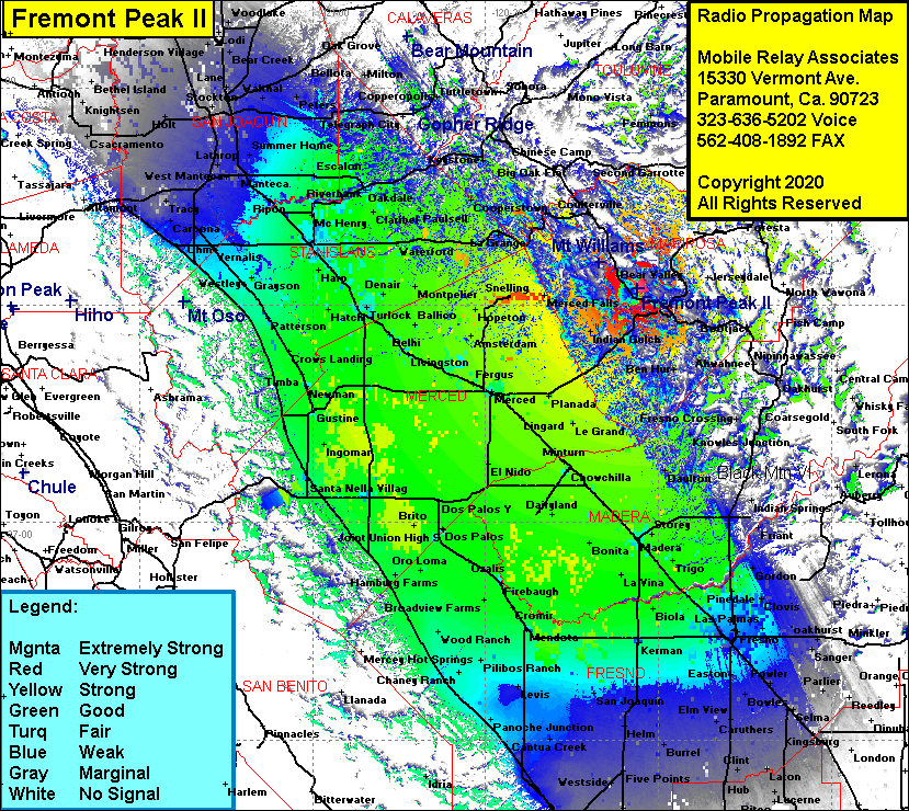 Fremont Peak II Coverage |
| Latitude: | 037 33 33.9N | 37.5594167 |
| Longitude: | 120 04 33.0W | -120.0758333 |
| Feet | Meters | |
| Ground Elevation: | 4211.0 | 1283.5 |
| HAAT: | 2086.5 | 636.0 |
| City: | Mt Bullion | |
| County: | Mariposa | |
| State: | California |
This is not an MRA Owned Site. For space rental contact the site owner.
Do you own or manage this site? Click Here
Would you like to add a site to the Google Earth Map?? Click Here
Site Coverage: Coverage of the San Joaquin Valley from Hanford in the south to Stockton in the north, Mt Bullion, Agua Fria, Mariposa, Mormon Bar, Bentjack, Bridgeport, Catheys Valley, Midpines, Elliott Corner, Briceburg, Bear Valley. Ragby, Hornitos, Indian Gulch, Ben Hur, Coulterville, Granite Springs, Dogtown, Merced Falls