Furnace Creek
| Site Name: | Furnace Creek | 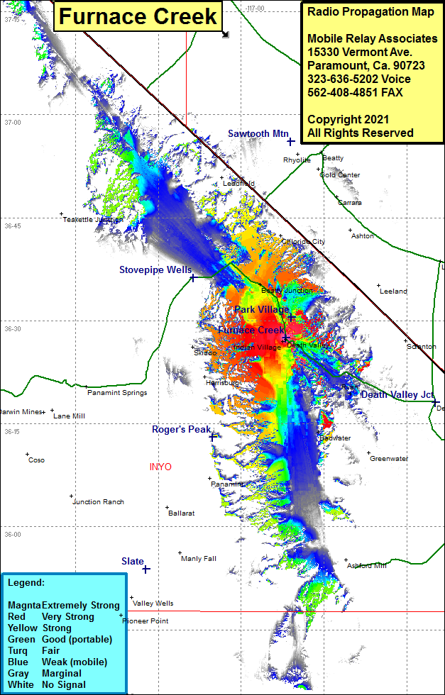 Furnace Creek Coverage |
| Latitude: | 036 27 28.3N | 36.4578611 |
| Longitude: | 116 51 57.0W | -116.8658333 |
| Feet | Meters | |
| Ground Elevation: | -171.0 | -52.1 |
| HAAT: | -899.7 | -274.2 |
| City: | Death Valley | |
| County: | Inyo | |
| State: | California |
This is not an MRA Owned Site. For space rental contact the site owner.
Do you own or manage this site? Click Here
Would you like to add a site to the Google Earth Map?? Click Here
Site Coverage: Coverage of Furnace Creek, Park Village, Beatty Junction, Daylight Pass Road, Daylight Pass Cutoff Road most of the way to the Nevada State Line, Scottys Castle Road until a mile before Death Valley National Park Road, California Highway 190 from Furnace Creek to about 2.5 miles before Stovepipe Wells, Badwater Road heading south from Furnace Creek to about 2 miles south of the dry lake bed then picks up again after about 5 miles of dead zone for about 2 miles