Gopher Ridge
| Site Name: | Gopher Ridge | 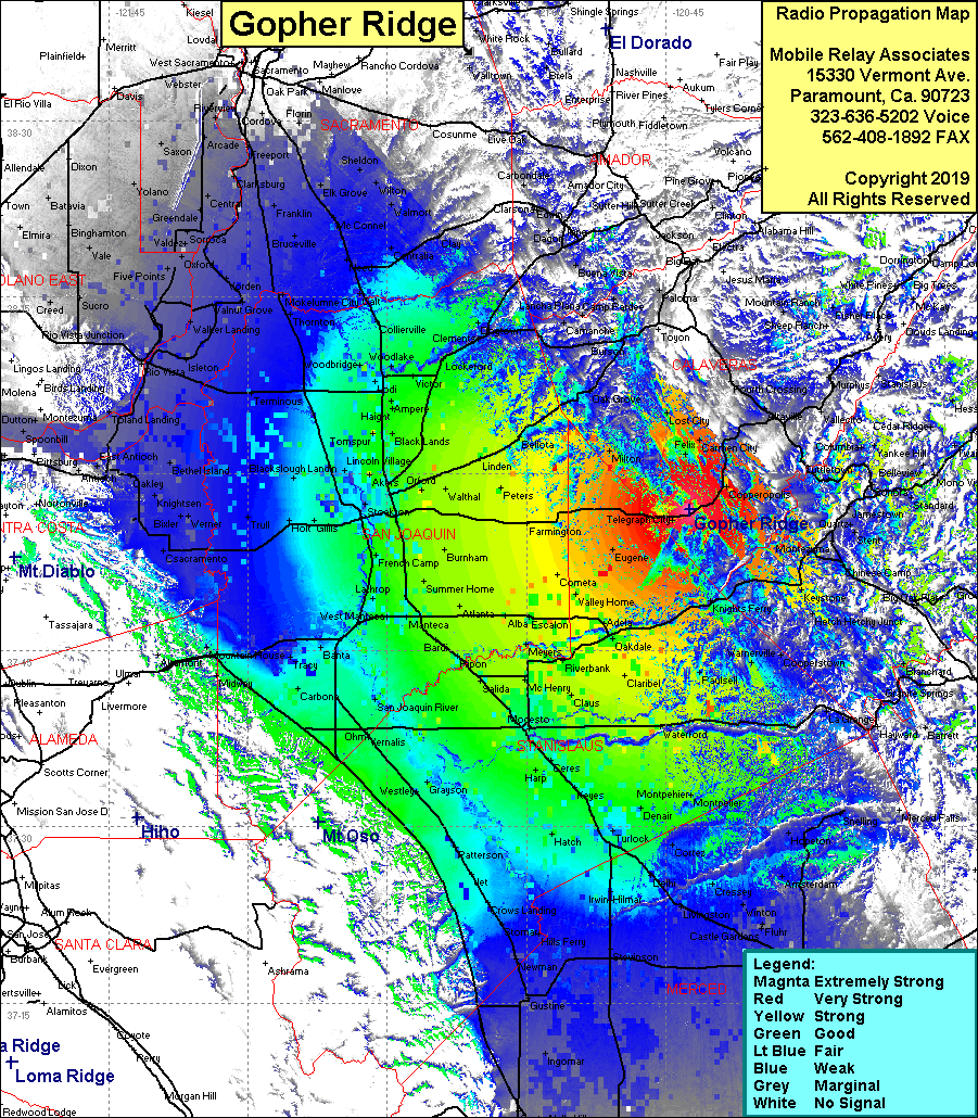 Gopher Ridge Coverage |
| Latitude: | 037 56 58.3N | 37.9495278 |
| Longitude: | 120 42 27.2W | -120.7075556 |
| Feet | Meters | |
| Ground Elevation: | 1,537.1 | 468.5 |
| HAAT: | 816.3 | 248.8 |
| City: | Telegraphic City | |
| County: | Calaveras | |
| State: | California |
This is not an MRA Owned Site. For space rental contact the site owner.
Do you own or manage this site? Click Here
Would you like to add a site to the Google Earth Map?? Click Here
Site Coverage: Coverage of the San Joaquin Valley, south to Dos Palos, north to Sacramento, Lost City, Copperopolis, Keystone, Tuttletown