Grant II
| Site Name: | Grant II | 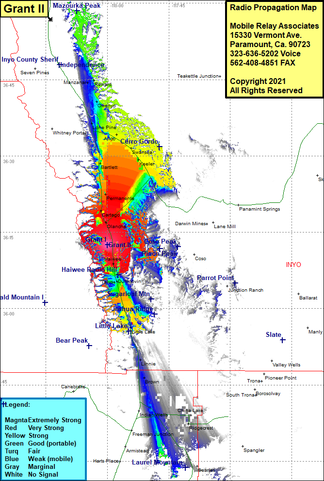 Grant II Coverage |
| Latitude: | 036 11 38.7N | 36.1940833 |
| Longitude: | 118 00 25.6W | -118.0071111 |
| Feet | Meters | |
| Ground Elevation: | 4620.0 | 1408.2 |
| HAAT: | -743.5 | -226.6 |
| City: | Grant | |
| County: | Inyo | |
| State: | California |
This is not an MRA Owned Site. For space rental contact the site owner.
Do you own or manage this site? Click Here
Would you like to add a site to the Google Earth Map?? Click Here
Site Coverage: Coverage of Grant, Cartago, Olancha, Permanente, Bartlett, Swansea, Keeler, Lone Pine, Owenyo, Reward, Manzanar, Dunmovin, Little Lake, Linnie, Brown, Ridgecrest, Inyokern