Grizzly Peak II
| Site Name: | Grizzly Peak II | 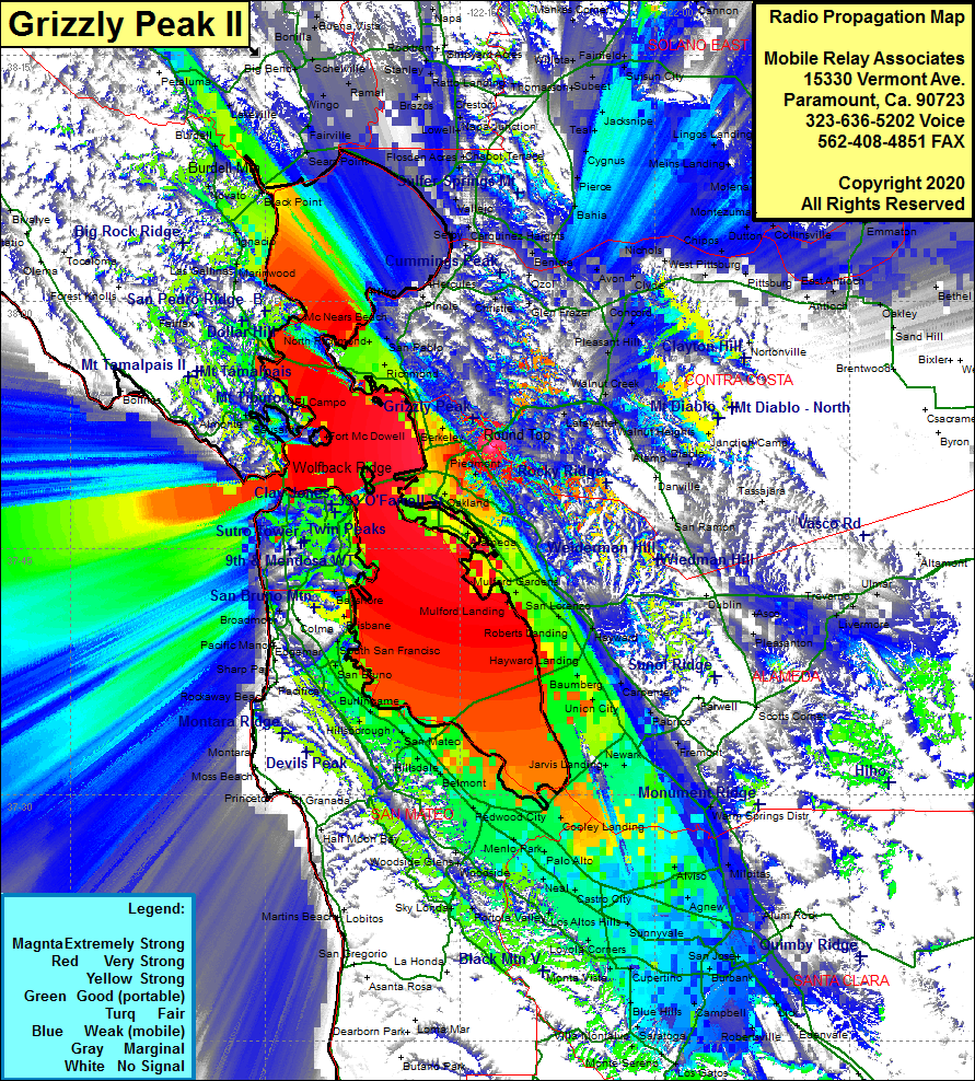 Grizzly Peak II Coverage |
| Latitude: | 037 51 09.3N | 37.8525833 |
| Longitude: | 122 12 34.6W | -122.2096111 |
| Feet | Meters | |
| Ground Elevation: | 1,463.0 | 445.9 |
| HAAT: | 1,159.0 | 353.3 |
| City: | Oakland | |
| County: | Alameda | |
| State: | California |
This is not an MRA Owned Site. For space rental contact the site owner.
Do you own or manage this site? Click Here
Would you like to add a site to the Google Earth Map?? Click Here
Site Coverage: Coverage of the San Francisco Bay area, south to San Jose, north to El Verano, Orinda Village, Canyon, San Francisco, Oakland, Richmond, Menlo Park