Harvey Jones SCSO Site
| Site Name: | Harvey Jones SCSO Site |  Harvey Jones SCSO Site Coverage |
| Latitude: | 041 44 59.7N | 41.7499167 |
| Longitude: | 121 15 25.6W | -121.2571111 |
| Feet | Meters | |
| Ground Elevation: | 4918.0 | 1499.0 |
| HAAT: | 627.9 | 191.4 |
| City: | Tionesta | |
| County: | Modoc | |
| State: | California |
This is not an MRA Owned Site. For space rental contact the site owner.
Do you own or manage this site? Click Here
Would you like to add a site to the Google Earth Map?? Click Here
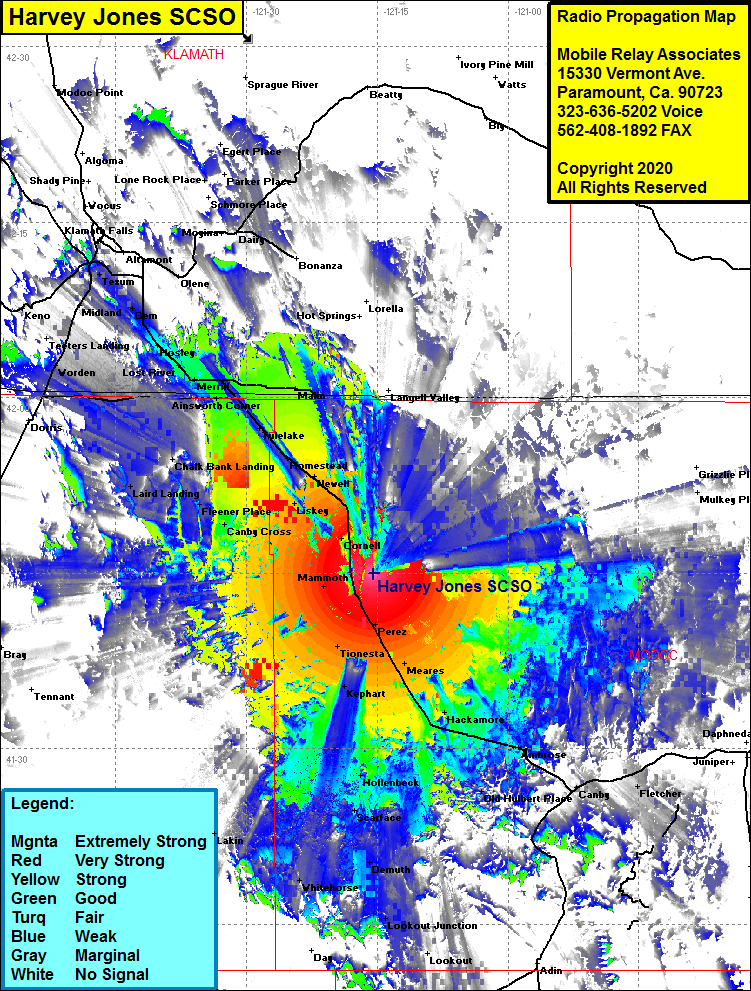
Site Coverage: Coverage of California Highway 139 from Ambrose in the south to north of the California-Oregon border, Ambrose, Boles, Hackamore, Mearles, Kephart, Tionesta, Perez, Cornell, Cupic, Liskey, Kandra, Newell, Homstead, Dalton, Tuber, Tulelake, Ainsworth Corner, Kalina, Adams Point, Malone, Merrill, Lost River, Malin, Stuken, Dehlinger, Gen, Laird Landing, Canby Cross, Fleener Place, Canby Cross, Hollenbeck, Scarface
