Hatchet Mtn
| Site Name: | Hatchet Mtn | 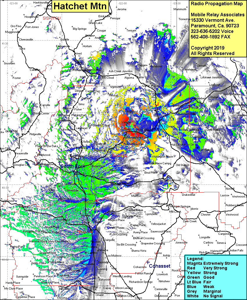 Hatchet Mtn Coverage |
| Latitude: | 040 54 20.8N | 40.9057778 |
| Longitude: | 121 49 43.5W | -121.8287500 |
| Feet | Meters | |
| Ground Elevation: | 5,570.9 | 1,698.0 |
| HAAT: | 2,060.7 | 628.1 |
| City: | Hillcrest | |
| County: | Shasta | |
| State: | California |
This is not an MRA Owned Site. For space rental contact the site owner.
Do you own or manage this site? Click Here
Would you like to add a site to the Google Earth Map?? Click Here
Site Coverage: Coverage of Redding, Anderson, Red Bluff, Casset, Hillcrest, Burney, Fall River Mills, Dixie, Newtown, Corning, Wyo, Palo Cedro