Hawkins Peak
| Site Name: | Hawkins Peak | 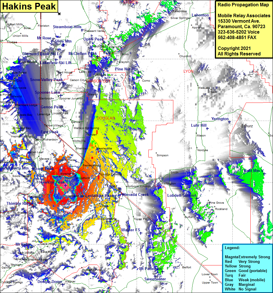 Hawkins Peak Coverage |
| Latitude: | 038 44 19.5N | 38.7387500 |
| Longitude: | 119 52 21.0W | -119.8725000 |
| Feet | Meters | |
| Ground Elevation: | 9956.0 | 3034.6 |
| HAAT: | 2,628.9 | 801.3 |
| City: | Sorensens | |
| County: | Alpine | |
| State: | California |
This is not an MRA Owned Site. For space rental contact the site owner.
Do you own or manage this site? Click Here
Would you like to add a site to the Google Earth Map?? Click Here
Site Coverage: Coverage of Sorensens, Woodfords, Markleeville, Paynesville, Fredericksburg, Youngs Crossing, Grays Crossing, Allen, Plasse, Kirkwood, Echo Lake, Dresslerville, Centerville, Minden, Buckeye, South Lake Tahoe, Zephyr Cove, the western shore of Lake Tahoe including Tallac Village, Camp Richardson, Inspiration Point, Emerald Bay, Meeks Bay, Chambers Lodge, Homewood, Tahoe Pines, Idlewild, Sunnyside, Tahoe City, Lake Forest, Camelian Bay, Tahoe Vista, Kings Beach, Incline Village, Crystal Bay