Joaquin Ridge
| Site Name: | Joaquin Ridge | 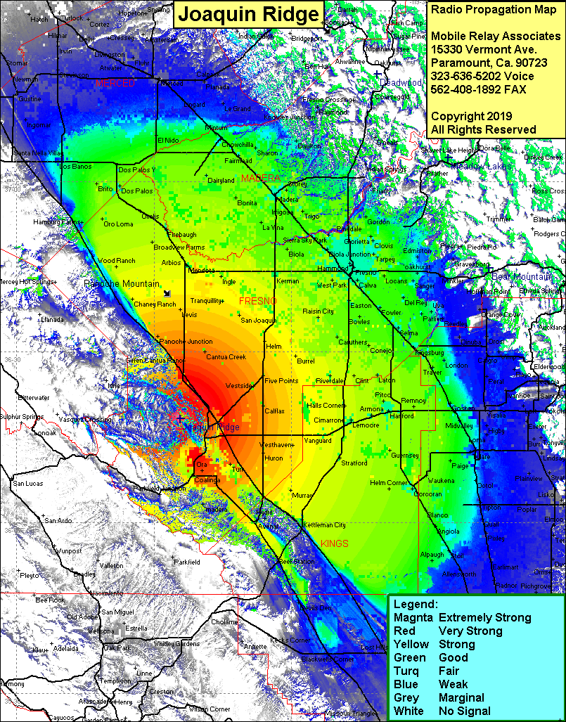 Joaquin Ridge Coverage |
| Latitude: | 036 18 18.8N | 36.3052222 |
| Longitude: | 120 24 12.6W | -120.4035000 |
| Feet | Meters | |
| Ground Elevation: | 3,599.1 | 1,097.0 |
| HAAT: | 2,219.6 | 676.5 |
| City: | Coalinga | |
| County: | Fresno | |
| State: | California |
This is not an MRA Owned Site. For space rental contact the site owner.
Do you own or manage this site? Click Here
Would you like to add a site to the Google Earth Map?? Click Here
Site Coverage: Coverage of the San Joaquin Valley, south to Bakersfield, north to Merced, Coalinga, Parkfield Jct, Panoche Jct, Panoche