Leviathan Peak
| Site Name: | Leviathan Peak | 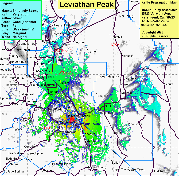 Leviathan Peak Coverage |
| Latitude: | 038 41 00.5N | 38.6834722 |
| Longitude: | 119 36 42.6W | -119.6118333 |
| Feet | Meters | |
| Ground Elevation: | 9021.7 | 2749.8 |
| HAAT: | 2480.4 | 756.0 |
| City: | Topaz Lake | |
| County: | Alpine | |
| State: | California |
This is not an MRA Owned Site. For space rental contact the site owner.
Do you own or manage this site? Click Here
Would you like to add a site to the Google Earth Map?? Click Here
Site Coverage: Coverage of Topaz Lake, Grays Crossing, Holbrook Jct, Wellington, Smith Coleville, Markleeville, Centerville, Gardnerville, Walleys Hot Spring, Sheridan, Centerville, Minden, Genoa, Buckeye, Paynesville, Woodlands, Dresslerville, Loope