Mt Diablo
| Site Name: | Mt Diablo | 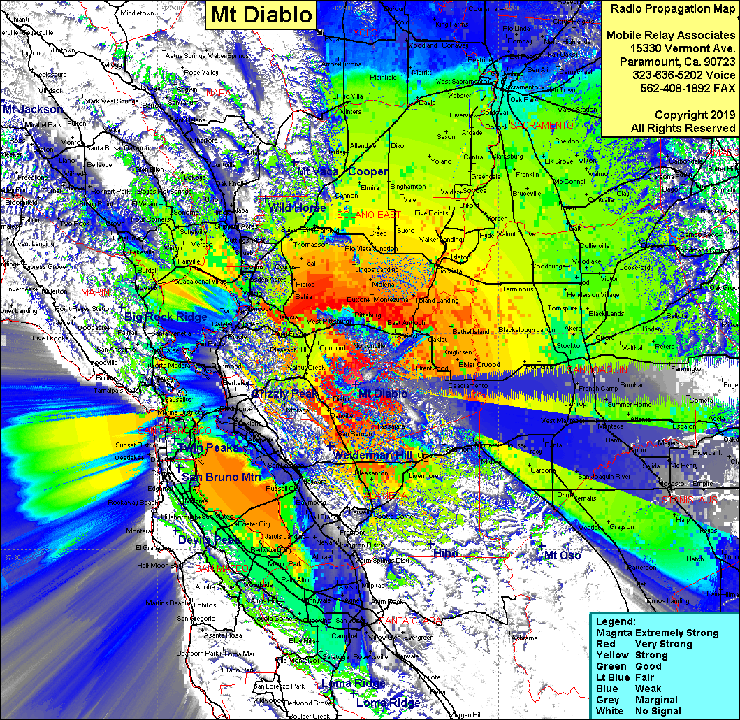 |
| Latitude: | 037 52 54.3N | 37.8817500 |
| Longitude: | 121 55 08.9W | -121.9191389 |
| Feet | Meters | |
| Ground Elevation: | 3,618.8 | 1,103.0 |
| HAAT: | 3,051.7 | 930.2 |
| City: | Walnut Creek | |
| County: | Contra Costa | |
| State: | California |
This is not an MRA Owned Site. For space rental contact the site owner.
Do you own or manage this site? Click Here
Would you like to add a site to the Google Earth Map?? Click Here
Site Coverage: Coverage of the San Francisco west bay, Pleasanton, Livermore, Walnut Creek, Benicia, San Joaquin Valley south to Merced and north to Yuba City