Mt Hough
| Site Name: | Mt Hough |  Mt Hough Coverage |
| Latitude: | 040 02 40.2N | 40.0445000 |
| Longitude: | 120 53 11.1W | -120.8864167 |
| Feet | Meters | |
| Ground Elevation: | 7129.3 | 2173.0 |
| HAAT: | 2718.8 | 828.7 |
| City: | Quincy | |
| County: | Plumas | |
| State: | California |
This is not an MRA Owned Site. For space rental contact the site owner.
Do you own or manage this site? Click Here
Would you like to add a site to the Google Earth Map?? Click Here
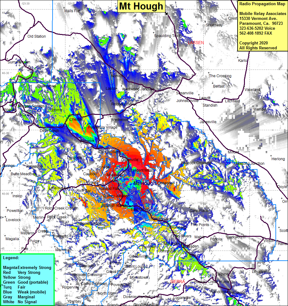
Site Coverage: Coverage of Peninsula Village, Chester, Almanor, Canyondam, Greenville, Moccasin, Indian Falls, Halsted Flat, Little Hayon, Meadow Valley, Spanish Ranch, Quincy, Quincy Jct, Spring Garden, Sloat, Cromberg, Two Rivers, Blairsden, Bucks Lodge, Longville, Deer Creek, Norvell, Lasco
