Mt Patterson
| Site Name: | Mt Patterson |  Mt Patterson Coverage |
| Latitude: | 038 23 18.4N | 38.3884444 |
| Longitude: | 119 21 58.3W | -119.3661944 |
| Feet | Meters | |
| Ground Elevation: | 10908.8 | 3325.0 |
| HAAT: | 2751.2 | 838.6 |
| City: | Fales Hot Springs | |
| County: | Mono | |
| State: | California |
This is not an MRA Owned Site. For space rental contact the site owner.
Do you own or manage this site? Click Here
Would you like to add a site to the Google Earth Map?? Click Here
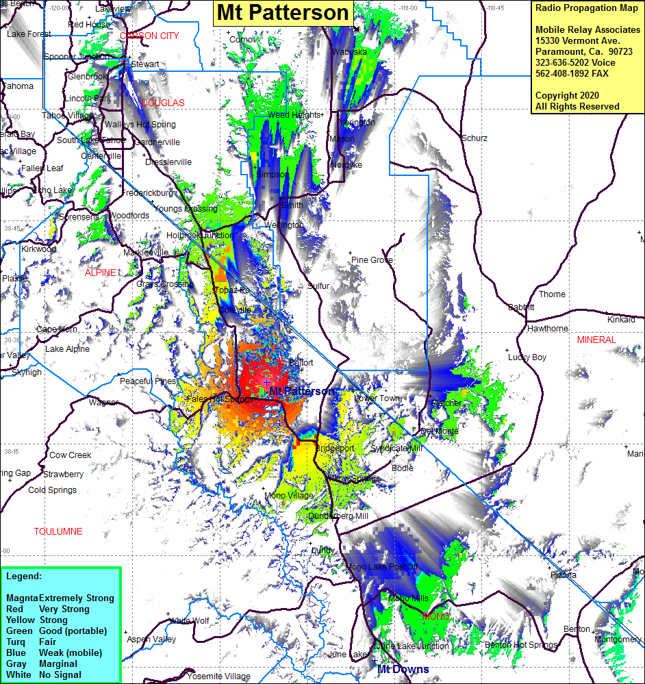
Site Coverage: Coverage of Bridgeport, Fales Hot Springs, Sonora Junction, Belfort, Coledale, Dunderberg Mill, Mono Mills, Mono Lake, Lower Town, Topaz Lake, Topaz, Grays Crossing, Holbrook Junction, Simpson, Wabuska, US395 from just north of Hwy 167 through Bridgeport to 2 miles north of the Nevada state line.
