Mt Pluto
| Site Name: | Mt Pluto | 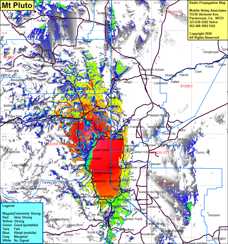 Mt Pluto Coverage |
| Latitude: | 039 14 29.3N | 39.2414722 |
| Longitude: | 120 08 24.7W | -120.1401944 |
| Feet | Meters | |
| Ground Elevation: | 8622.0 | 2628.0 |
| HAAT: | 1416.2 | 431.7 |
| City: | Truckee | |
| County: | Placer | |
| State: | California |
This is not an MRA Owned Site. For space rental contact the site owner.
Do you own or manage this site? Click Here
Would you like to add a site to the Google Earth Map?? Click Here
Site Coverage: Coverage of the Interstate 80 corridor and the Lake Tahoe Basin including Tahoe City, Lake Forest, Sunnyside, Idlewild, Homewood, Meeks Bay, Inspiration Point, Tallac Village, Lake Valley, Al tahoe, South Lake Tahow, Edgewood, Tahoe Village, Zephyr Cove, Skyland, Lincoln Park, Lakeridge, Glenbrook, Spooner Jct, Crystal Bay, Incline Village, King Beach, Tahoe vista, Truckee, Polaris, Union Mills, Hirschdale, Iceland, Boca, Hobart Mills, Gateway, Andover, Eder, Soda Springs, Mystic, Sttley, Calpine, Hallelujah Jct, Beckwourth, Mevers, Echo Lake, Nebelhorn