Mt St Helena
| Site Name: | Mt St Helena | 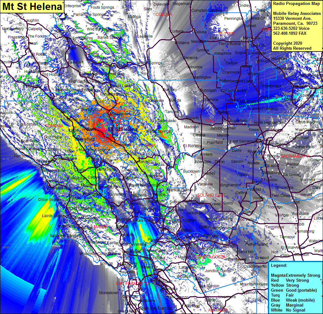 Mt St Helena Coverage |
| Latitude: | 038 40 08.8N | 38.6691111 |
| Longitude: | 122 37 54.9W | -122.6319167 |
| Feet | Meters | |
| Ground Elevation: | 4299.0 | 1310.3 |
| HAAT: | 2985.5 | 910.0 |
| City: | Kellogg | |
| County: | Sonoma | |
| State: | California |
This is not an MRA Owned Site. For space rental contact the site owner.
Do you own or manage this site? Click Here
Would you like to add a site to the Google Earth Map?? Click Here
Site Coverage: Coverage of Sonoma County including Kellogg, Calistoga, Krug, Sanitarium, Krug, Thomart, Rutherford, Yountville, Oak Knoll, Vichy Springs, Union, Napa, Stanley, Bazos, Lowell, Creston, Hhipyard Acres, Sonoma, Ramal, Fairville, Sears Point, Burdell, Black Point, Liberty, Roblas, Rohnert Park, WIlfred, Bellevue, Llano, Cunningham, Two Rock, Mirabel Park, WIlson Grove, Windsor, Healdsburg, Lytton, Jimtown, Geyersville, Omus, Chianti, Asti, Cloverdale, Mercuryville, Castle Rock Spring, Harbin Springs Ann, Bonanza SPrings and much more