Mt Williams
| Site Name: | Mt Williams | 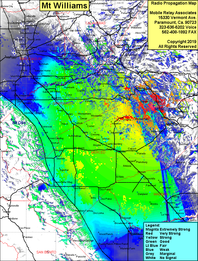 Mt Williams Coverage |
| Latitude: | 037 36 00.1N | 37.6000278 |
| Longitude: | 120 10 14.0W | -120.1705556 |
| Feet | Meters | |
| Ground Elevation: | 3,193.9 | 973.5 |
| HAAT: | 1,557.5 | 474.7 |
| City: | Coulterville | |
| County: | Mariposa | |
| State: | California |
This is not an MRA Owned Site. For space rental contact the site owner.
Do you own or manage this site? Click Here
Would you like to add a site to the Google Earth Map?? Click Here
Site Coverage: Coverage of the San Joaquin Valley, south to San Joaquin, north to Lodi, Bear Valley, Coulterville, Blanchard, Agua Fria, Merced Falls