Nevada Creek
| Site Name: | Nevada Creek | 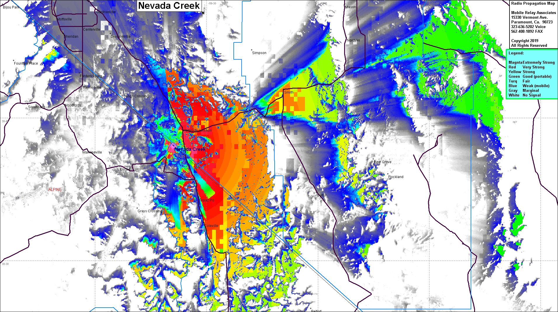 Nevada Creek Coverage |
| Latitude: | 038 42 06.4N | 38.7017778 |
| Longitude: | 119 34 27.6W | -119.5743333 |
| Feet | Meters | |
| Ground Elevation: | 7,675.9 | 2,339.6 |
| HAAT: | 1,309.1 | 399.0 |
| City: | Topaz | |
| County: | Mono | |
| State: | California |
This is not an MRA Owned Site. For space rental contact the site owner.
Do you own or manage this site? Click Here
Would you like to add a site to the Google Earth Map?? Click Here
Site Coverage: Coverage of Coleville, Topaz, Holbrook Junction, Wellington, Smith, north to Dresslerville, Minden