Panoche Mtn
| Site Name: | Panoche Mtn | 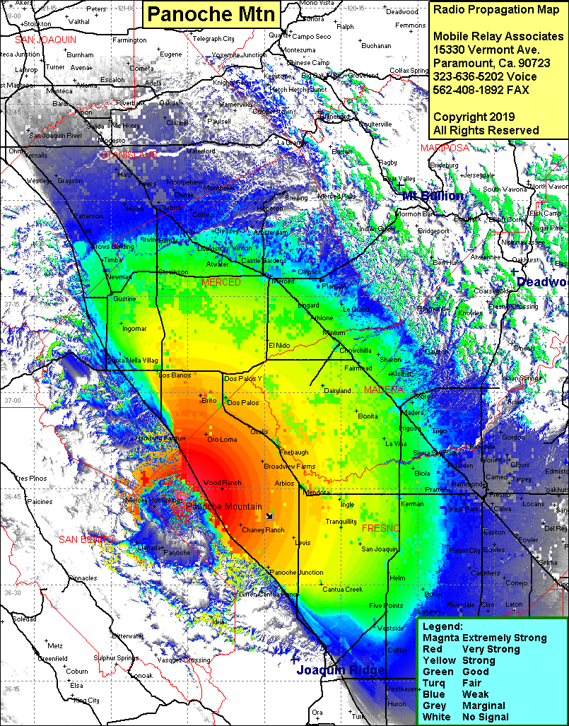 Panoche Mtn Coverage |
| Latitude: | 036 43 31.8N | 36.7255000 |
| Longitude: | 120 45 52.7W | -120.7646389 |
| Feet | Meters | |
| Ground Elevation: | 2,093.2 | 638.0 |
| HAAT: | 1,135.1 | 346.0 |
| City: | Panoche | |
| County: | Fresno | |
| State: | California |
This is not an MRA Owned Site. For space rental contact the site owner.
Do you own or manage this site? Click Here
Would you like to add a site to the Google Earth Map?? Click Here
Site Coverage: Coverage of the San Joaquin Valley, south to Kettleman City, north to Manteca, Panoche, Llanta, Mercy Hot Springs