Parrot Point
| Site Name: | Parrot Point | 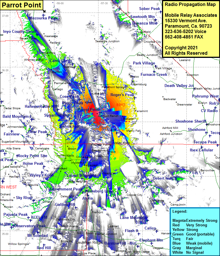 Parrot Point Coverage |
| Latitude: | 036 05 00.2N | 36.0833889 |
| Longitude: | 117 28 52.5W | -117.4812500 |
| Feet | Meters | |
| Ground Elevation: | 8367.0 | 2550.3 |
| HAAT: | 3302.7 | 1006.7 |
| City: | Coso | |
| County: | Inyo | |
| State: | California |
This is not an MRA Owned Site. For space rental contact the site owner.
Do you own or manage this site? Click Here
Would you like to add a site to the Google Earth Map?? Click Here
Site Coverage: Coverage of Junction Ranch, Ballarat, Panamint, Manly Fall, Valley Wells, Pioneer Point, Trona, South Trona, Borosolvay, Spangler, China Lake, Ridgecrest, Searles, Inyokern, Indian Wells, Brown, Linnie, Freeman Junction, Armistead, Ricardo, Cinco, Mojave, Flets, Biswell, North Edwards, Aerial Acres, California City, Fremont, Kramer Jct, Kramer Hills, Harrisburg, Lone Pine, Owenyo, Seven Pines