Pierce Mountain
| Site Name: | Pierce Mountain | 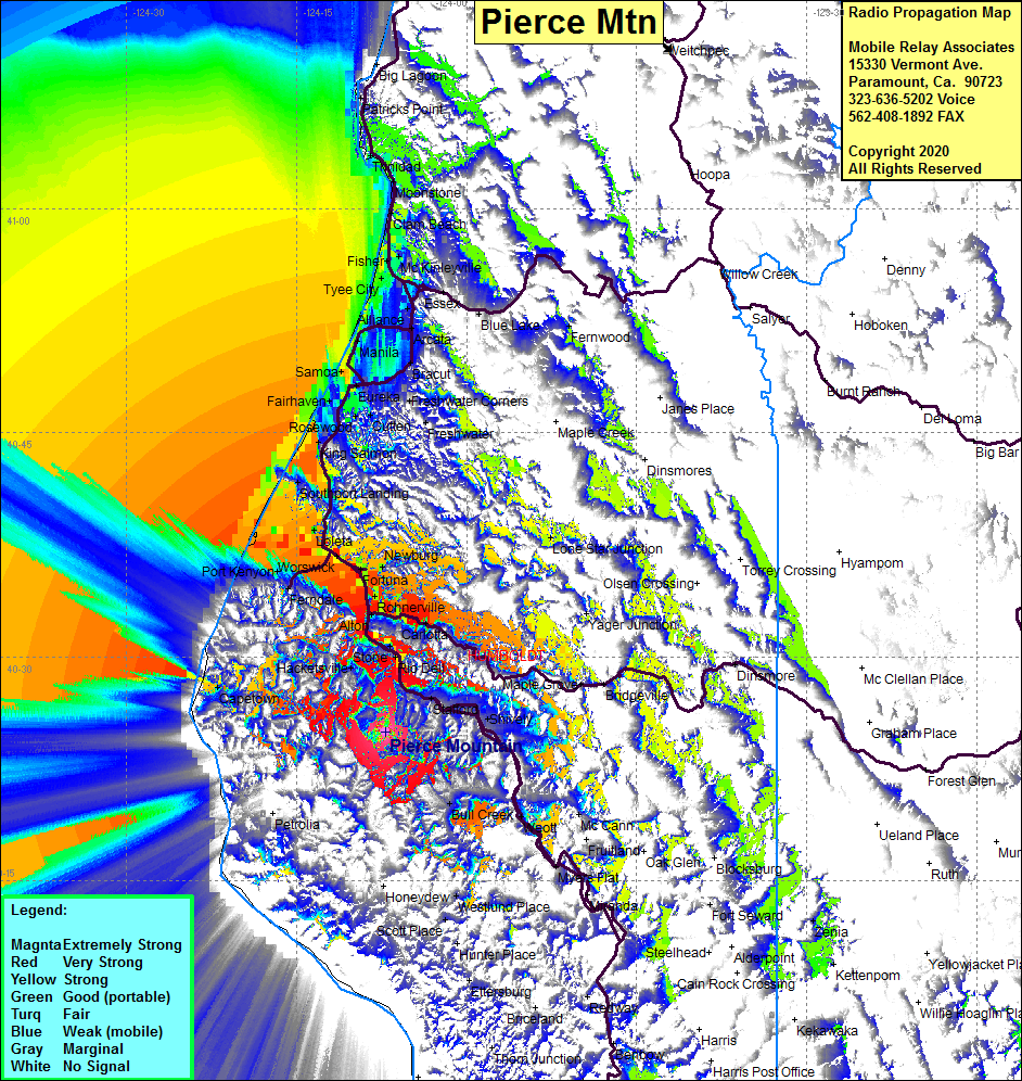 Pierce Mountain Coverage |
| Latitude: | 040 24 59.0N | 40.4163889 |
| Longitude: | 124 07 12.1W | -124.1200278 |
| Feet | Meters | |
| Ground Elevation: | 3191.9 | 972.9 |
| HAAT: | 1960.9 | 597.7 |
| City: | Rio Del | |
| County: | Humboldt | |
| State: | California |
This is not an MRA Owned Site. For space rental contact the site owner.
Do you own or manage this site? Click Here
Would you like to add a site to the Google Earth Map?? Click Here
Site Coverage: Coverage of Holmes, Pepperwood, Stafford, Hacketsville, Belleview, Stone, Alton, Rohnerville, Fortuna, Newburg, Ferngridge, Loleta, Beatrice, Fields Landing, King Salmon, Samoa, Fairhaven, Eureka, Bracut, Bayside, Arcata, Alliance, Tyee City, Fisher, McKinleyville, Esses, Blue Lake, Moonstone, Westhaven, Trinidad, Patricks Point, Bull Creek, Weott, Bridgeville, Lone Star Junction, Culton, Freshwater Corners