Pine Hill
| Site Name: | Pine Hill | 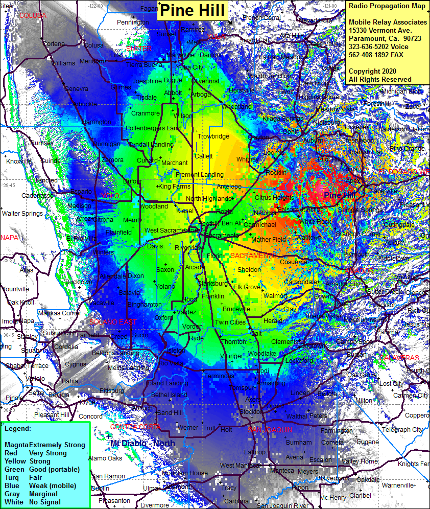 Pine Hill Coverage |
| Latitude: | 038 43 10.1N | 38.7194722 |
| Longitude: | 120 59 26.7W | -120.9907500 |
| Feet | Meters | |
| Ground Elevation: | 2035.1 | 620.3 |
| HAAT: | 1067.7 | 325.4 |
| City: | Clarksville | |
| County: | Eldorado | |
| State: | California |
This is not an MRA Owned Site. For space rental contact the site owner.
Do you own or manage this site? Click Here
Would you like to add a site to the Google Earth Map?? Click Here
Site Coverage: Coverage of the San Joaquin Valley south to Pinon and north to Sutter Butes, Skinners, El Dorado, Placerville, Smith Flat, Apex, Lotus, Buffalo Hill, Greenwood, Pornis, Todd Valley, Foresthill, Nielsburg, Meadow Vista, Weimar, Plumtree Crossing, Dew Drop, Newcastle, Penryn, Gold Hill, Clayton, Whitney, Kilaga Springs, Wolf