Pioneer Place Lift
| Site Name: | Pioneer Place Lift | 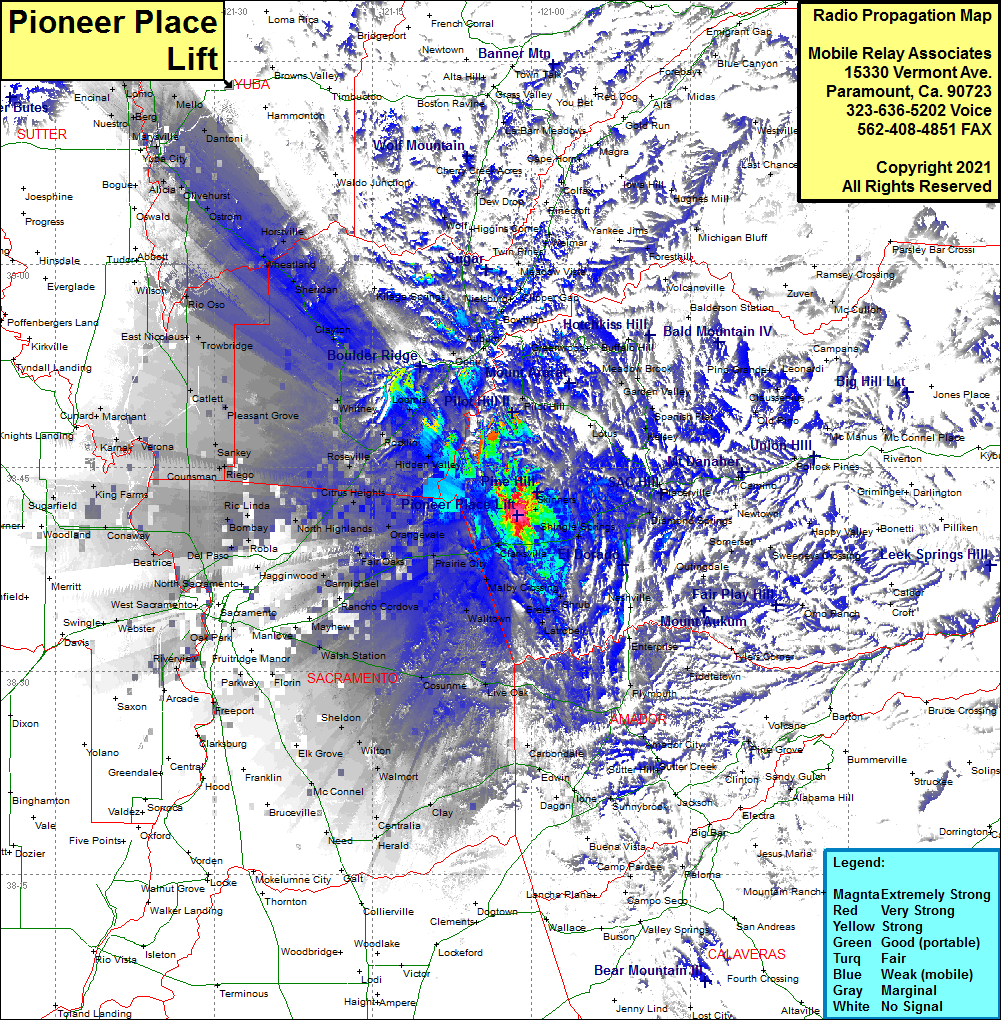 Pioneer Place Lift Coverage |
| Latitude: | 038 41 27.9N | 38.6910833 |
| Longitude: | 121 01 16.0W | -121.0211111 |
| Feet | Meters | |
| Ground Elevation: | 1128.0 | 343.8 |
| HAAT: | 258.2 | 78.7 |
| City: | Cameron Park | |
| County: | El Dorado | |
| State: | California |
This is not an MRA Owned Site. For space rental contact the site owner.
Do you own or manage this site? Click Here
Would you like to add a site to the Google Earth Map?? Click Here
Site Coverage: Coverage of Skinners, Shingle Springs, Kingsville, El Dorado, Diamond Springs, Tiger Lily, Placerville, Perks Corner, Shingle Springs, Frenchtown, Brandon Corner, bullard, Shrub, Brela, Flonellis, Latrobe, Malby Crossing, Clarksville, White Rock, Walltown, Prairie City, Alder Creek, Nimbus, Citrus, Fair Oaks, Natoma, Folsom Junction, Folsom, Orangevals, Citrus Heights, Roseville, Rocklin, Loomis, Penryn, Newcastle, Pilot Hill, Lotus, Coloma, Kelsey, Spanish flat, meadow Brook, Garden Valley, Dugan, Bullard, Brandon Corner, Brela, Live Oak, Carbondale, Edwin, Clay, Centralia, Herald, Need, McConnel, Dillard, Sheldon, Cosunme, Walsh Station, Manlove, Florin, Parkway, Manlove, Mayhew, Sacramento, Riverview, Walsh Station, Mather Field, Rancho Cordova, Carmichael, Fiar Oaks, Natoma, Orangevale, Del Paso, Bombay, Rio Linda, North Highlands, Citrus Heights, Roseville, Elverta, Sankey, Joes Landing, Catlett, Pleasant Grove, Whitney, Rocklin, Loomis, Penryn, Ophir, Gold Hill, Whitney, Clayton, Sheridan, Kilega Springs, Wheatland, Horstville, Rio Oso, Ostrom, Olivehurse, Oswald, Alicia, Yuba City, Dantoni, Mello, Tambo, Marysville, Berg, Lorno, Sunset