Potato Hill
| Site Name: | Potato Hill | 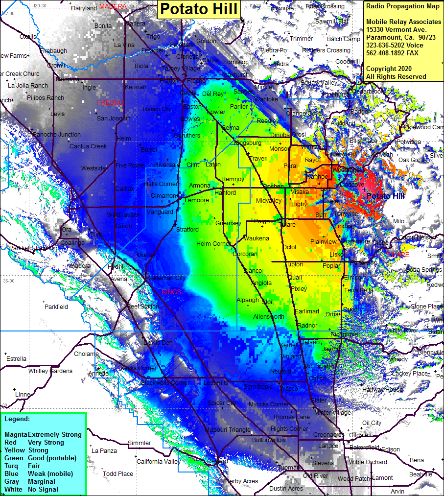 Potato Hill Coverage |
| Latitude: | 036 19 11.9N | 36.3199722 |
| Longitude: | 118 56 39.4W | -118.9442778 |
| Feet | Meters | |
| Ground Elevation: | 2877.3 | 877.0 |
| HAAT: | 1182.0 | 360.3 |
| City: | Exeter | |
| County: | Tulare | |
| State: | California |
This is not an MRA Owned Site. For space rental contact the site owner.
Do you own or manage this site? Click Here
Would you like to add a site to the Google Earth Map?? Click Here
Site Coverage: Coverage of the San Joaquin Valley from Bakersfield in the south and Madera in the north, Three Rivers, Hammond, Burr, Citro, Goodale, Lindcove, Naranjo, Saint Johns, Fane, Lort, West Venida, Sequoia, Redbanks, Hillmaid, Potwisha, Ellis Place