Pratt Mtn
| Site Name: | Pratt Mtn | 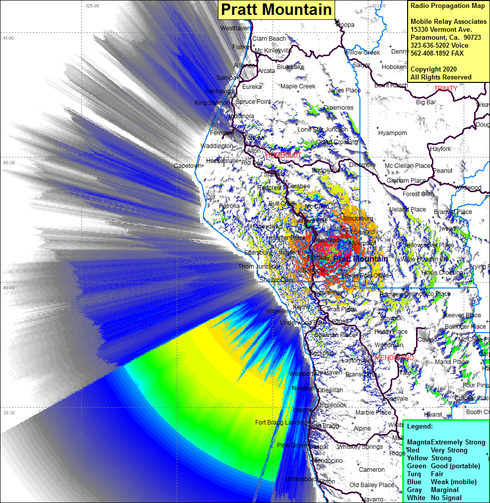 Pratt Mtn Coverage |
| Latitude: | 040 07 11.3N | 40.1198056 |
| Longitude: | 123 41 34.7W | -123.6929722 |
| Feet | Meters | |
| Ground Elevation: | 3897.0 | 1187.8 |
| HAAT: | 2536.9 | 773.3 |
| City: | Garberville | |
| County: | Humboldt | |
| State: | California |
This is not an MRA Owned Site. For space rental contact the site owner.
Do you own or manage this site? Click Here
Would you like to add a site to the Google Earth Map?? Click Here
Site Coverage: Coverage of Harris, Cain Rock Crossing, Alderpoint, Steelhead, Garberville, Redway, Phillipsville, Miranda, Burlington, Weott, Fruitland, Oak Glen, Blocksburg, Zenia, Fort Seward, Kettenporn, Kekawaka, Bell Springs, Pratt Place, Andersonia, Cooks Valley, Beall Place, Whitethorn, Thorn Junction, Ihayfork, Bryceland, Ettersburg, Hunter Place, Westlund Place, Honeydew, Shively, Pepperwood, Alton, Fortuna, Fernbridge, Port Kenyon, King Salmon