Red Mtn III
| Site Name: | Red Mtn III | 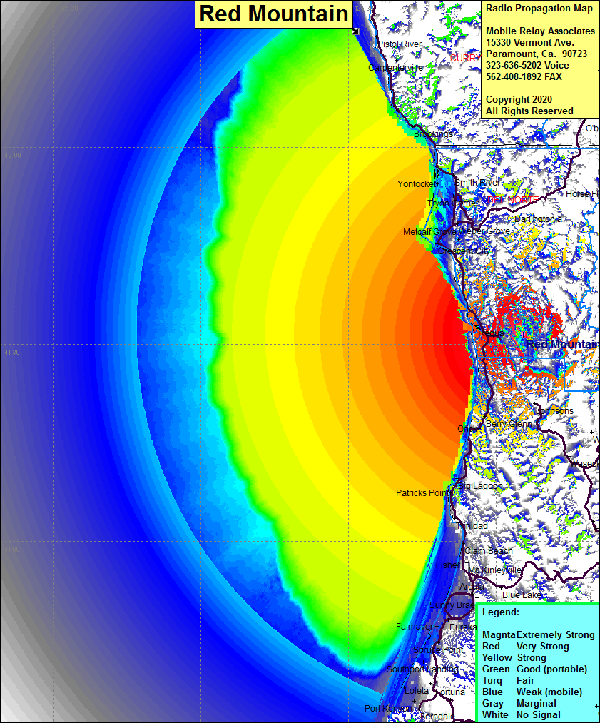 Red Mtn III Coverage |
| Latitude: | 041 31 27.4N | 41.5242778 |
| Longitude: | 123 54 30.2W | -123.9083889 |
| Feet | Meters | |
| Ground Elevation: | 4150.3 | 1265.0 |
| HAAT: | 2461.2 | 750.2 |
| City: | Klamath | |
| County: | Del Norte | |
| State: | California |
This is not an MRA Owned Site. For space rental contact the site owner.
Do you own or manage this site? Click Here
Would you like to add a site to the Google Earth Map?? Click Here
Site Coverage: Coverage of Klammath, Klammath Glen, Requa, Crescent City, Metcalf, Metcalf Grove, Tyron Corner, Smith River, Yontocket, Fort Dick, Weber Grove, Berry Glen. Orick, Big Lagoon, Patricks Point, Moonstone, Westhaven, Clam Beach, Fisher, Calville, Alliance, Manila, Samoa, Eureka, Rosewood, King Salmon, Spruce Point, Southport Landing, Port Kenyon, Fairhaven