Rolph Mtn
| Site Name: | Rolph Mtn | 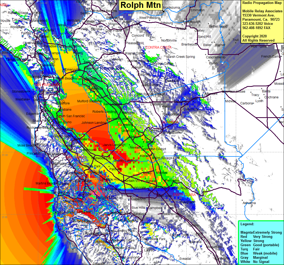 Rolph Mtn Coverage |
| Latitude: | 037 19 51.0N | 37.3308333 |
| Longitude: | 122 12 50.0W | -122.2138889 |
| Feet | Meters | |
| Ground Elevation: | 2368.8 | 722.0 |
| HAAT: | 1403.9 | 427.9 |
| City: | La Honda | |
| County: | San Mateo | |
| State: | California |
This is not an MRA Owned Site. For space rental contact the site owner.
Do you own or manage this site? Click Here
Would you like to add a site to the Google Earth Map?? Click Here
Site Coverage: Coverage of the San Francisco Bay area, East Bay, West Bay, South Bay, La Ronda, Los Trancos Woods, Portola Valley, Redwood Terrace, San Gregorio, Asanta Rosa, Pescadero, Loma Mar, Dearborn Park, Butano Park, Martins Beach, Lobitos, Half Moon Bay, Miramar, El Granada, Princeton, Seal Cove, Moss Beach, Brook Creek, Brookdale