Shoshone Sheriff
| Site Name: | Shoshone Sheriff | 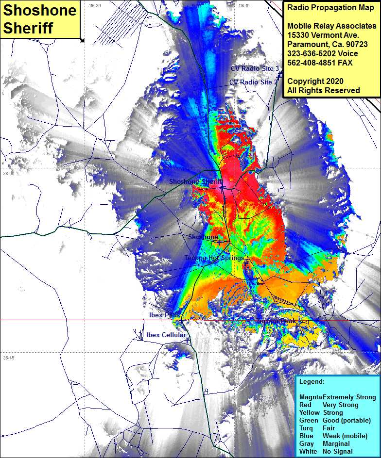 |
| Latitude: | 035 58 28.4N | 35.9745556 |
| Longitude: | 116 16 10.9W | -116.2696944 |
| Feet | Meters | |
| Ground Elevation: | 1577.0 | 480.7 |
| HAAT: | -519.8 | -158.4 |
| City: | Shoshone | |
| County: | Inyo | |
| State: | California |
This is not an MRA Owned Site. For space rental contact the site owner.
Do you own or manage this site? Click Here
Would you like to add a site to the Google Earth Map?? Click Here
Site Coverage: Coverage of Shoshone, Highway 127 from the Inyo County line to Shoshone and north several miles to 5 miles north of Evelyn, California Highway 178 from Shoshone for approximately 3 miles until you reach the mountain pass heading to the Chicago Valley. The story of installing this site
