Stovepipe Wells
| Site Name: | Stovepipe Wells | 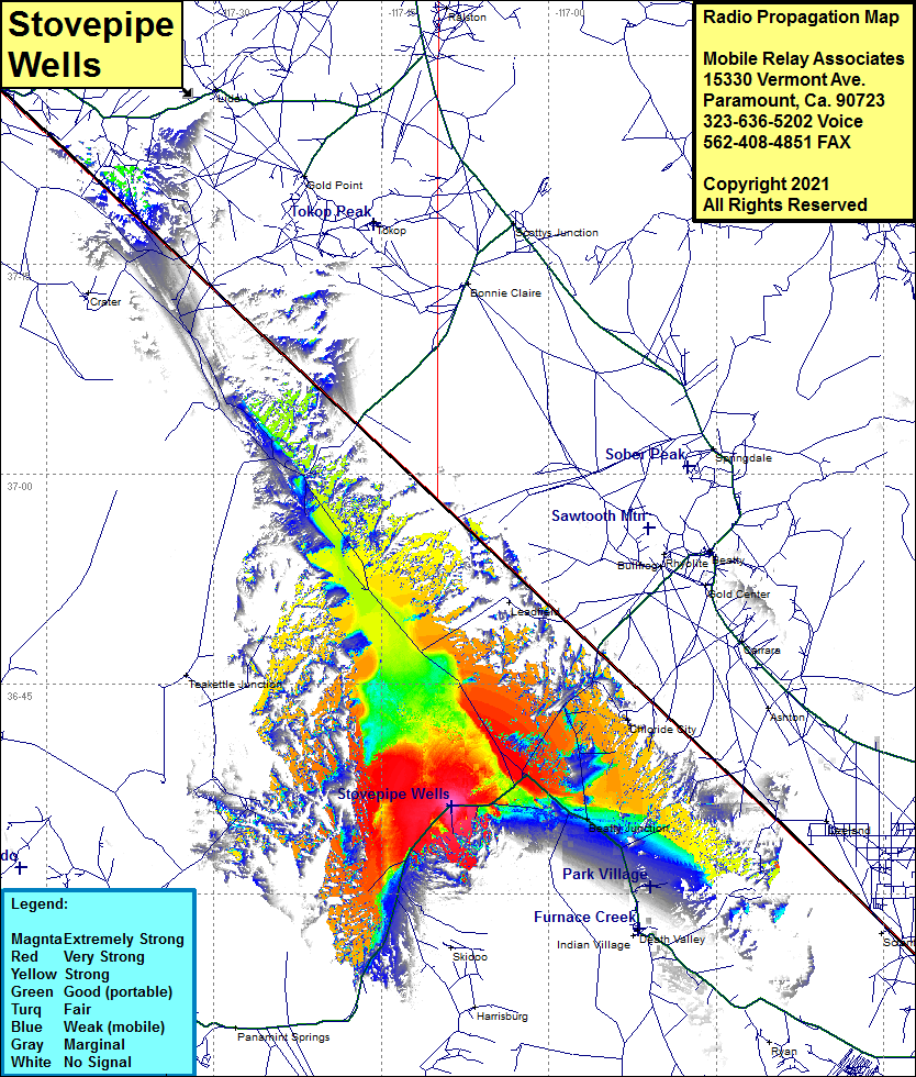 Stovepipe Wells Coverage |
| Latitude: | 036 36 16.1N | 36.6044722 |
| Longitude: | 117 08 41.8W | -117.1449444 |
| Feet | Meters | |
| Ground Elevation: | 36.0 | 11.0 |
| HAAT: | -1,012.7 | -308.7 |
| City: | Stovepipe Wells | |
| County: | Inyo | |
| State: | California |
This is not an MRA Owned Site. For space rental contact the site owner.
Do you own or manage this site? Click Here
Would you like to add a site to the Google Earth Map?? Click Here
Site Coverage: Coverage of Stovepipe Wells, Beatty Junction, Daylight Pass Cutoff Rd, Daylight Pass Road from California Highway 190 for about 12 miles, California Highway 190 from one mile north of Park Village to Scottys Castle Road and continuing southwest past Stovepipe Wells for about 15 miles, Scottys Castle Road until you pass Ubehee Crater Road.