Sugarloaf Mtn
| Site Name: | Sugarloaf Mtn | 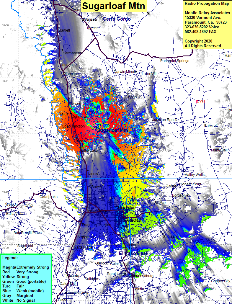 Sugarloaf Mtn Coverage |
| Latitude: | 036 01 52.3N | 36.0311944 |
| Longitude: | 117 49 21.4W | -117.8226111 |
| Feet | Meters | |
| Ground Elevation: | 5128.0 | 1563.0 |
| HAAT: | 968.9 | 295.3 |
| City: | Coso Junction | |
| County: | Inyo | |
| State: | California |
This is not an MRA Owned Site. For space rental contact the site owner.
Do you own or manage this site? Click Here
Would you like to add a site to the Google Earth Map?? Click Here
Site Coverage: Coverage of Little Lake, Coso, Coso Junction, Sykes, Talus, Dunmovin, Linnie, Brown, Indian Wells, Inyokern, Freeman Junction, Arnistead, Ridgecrest, China Lake, Harts Palce, Searles, Junction Ranch, Haiwee, Olancho, Cartago, Permanente, Barlett, Lone PPine, Dolomite, Alico, Owen, Spangler, Randsburg