Sutro Tower
| Site Name: | Sutro Tower | 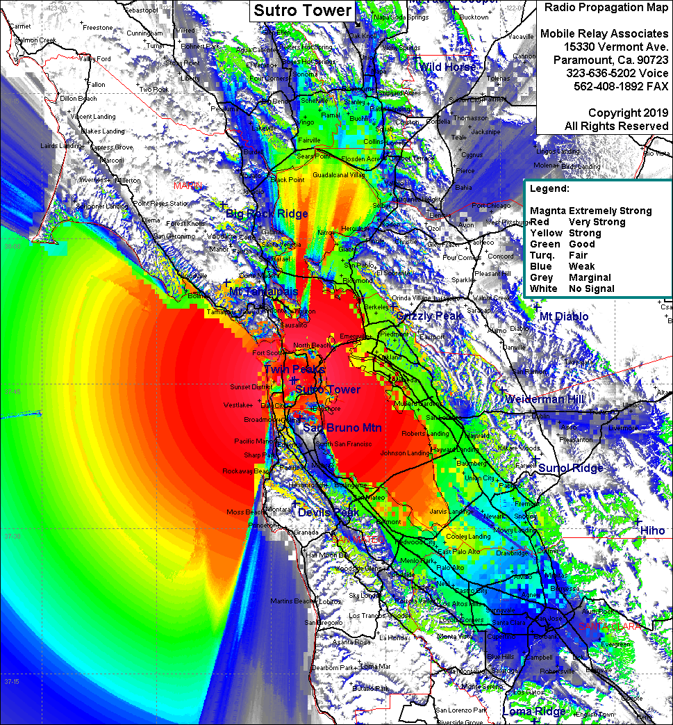 Sutro Tower Coverage |
| Latitude: | 037 45 18.9N | 37.7552500 |
| Longitude: | 122 27 10.2W | -122.4528333 |
| Feet | Meters | |
| Ground Elevation: | 828.0 | 252.4 |
| HAAT: | 1,557.4 | 474.7 |
| City: | San Francisco | |
| County: | San Francisco | |
| State: | California |
This is not an MRA Owned Site. For space rental contact the site owner.
Do you own or manage this site? Click Here
Would you like to add a site to the Google Earth Map?? Click Here
Site Coverage: Coverage of the San Francisco Bay Area, south to Robertsville, north to Agua Caliente, San Francisco, Broadmoor, San Bruno, Sausalito