Telegraph Hill
| Site Name: | Telegraph Hill |  Telegraph Hill Coverage |
| Latitude: | 038 01 51.7N | 38.0310278 |
| Longitude: | 120 21 05.7W | -120.3515833 |
| Feet | Meters | |
| Ground Elevation: | 3737.9 | 1139.3 |
| HAAT: | 1433.8 | 437.0 |
| City: | Columbia | |
| County: | Tuolumne | |
| State: | California |
This is not an MRA Owned Site. For space rental contact the site owner.
Do you own or manage this site? Click Here
Would you like to add a site to the Google Earth Map?? Click Here
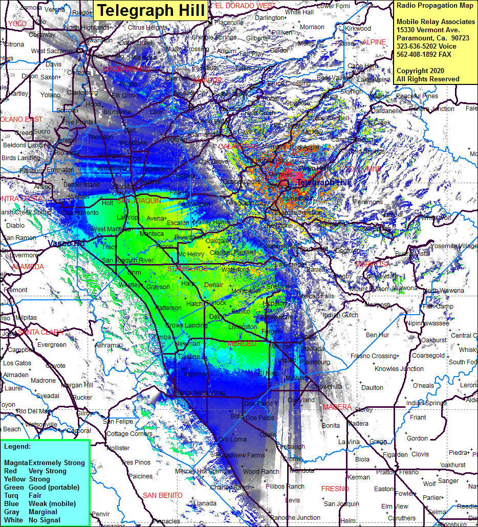
Site Coverage: Coverage of the San Joaquin Valley south to Fresno and north to Sacramento, Columbia, Yankee Hill, Sunshine Camp, Standard, Ralph, Tuolomne, Cherokee, Mono Vista, Cedar Rock Lodge, Twain Hart, Mi-Wuk Village, Long Barn, Sylvan Lodge, Hess Mill, Jupiter, Deadwood, Chinese Camp, Keystone, Hetch Hetchy Jct, Cooperstown, Warnerville, Groveland, Buchanan, Knights Ferry, Telegraph City, Felix, Lost City, Angels Camp, Vallecity, Murphys, Red Apple, Avery, Dorrington, Camp Connell, Cave City, Mountain Ranch, Fisher Ranch
