Timber Mtn II
| Site Name: | Timber Mtn II | 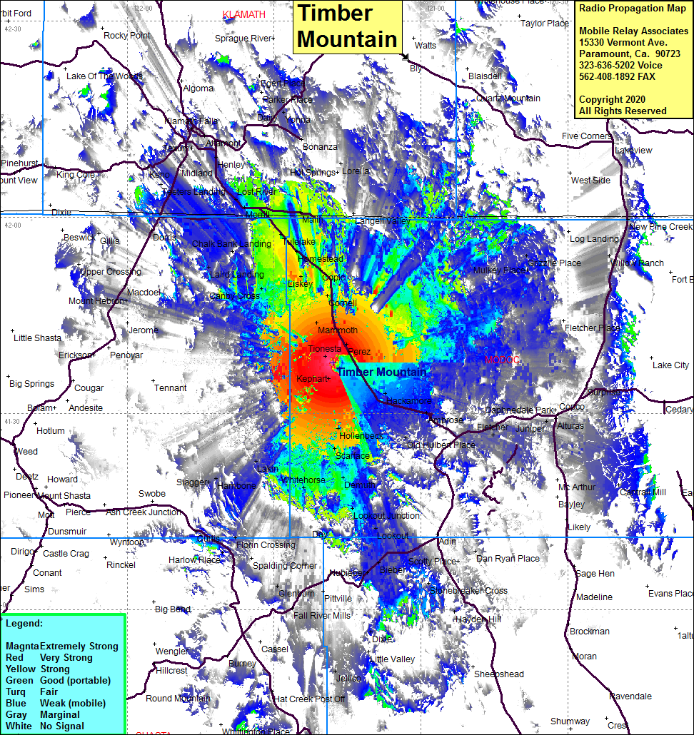 Timber Mtn II Coverage |
| Latitude: | 041 37 46.5N | 41.6295833 |
| Longitude: | 121 17 56.9W | -121.2991389 |
| Feet | Meters | |
| Ground Elevation: | 5003.3 | 1525.0 |
| HAAT: | 637.3 | 194.2 |
| City: | Tionesta | |
| County: | Modoc | |
| State: | California |
This is not an MRA Owned Site. For space rental contact the site owner.
Do you own or manage this site? Click Here
Would you like to add a site to the Google Earth Map?? Click Here
Site Coverage: Coverage of the western portion of Modoc County, Tionesta, Kephart, Perez, Mammoth, Cornell, Liskey, Stronghold, Tulelake, Malin, Langell Valley, Chalk Bank Landing, Laird Landing, Canby Cross, Lakin, Whitehorse, Lookout Jct, Scarface, Hollenbeck, Old Hulbert Palce, Ambrose, Hackamore, Mulkey Place, Grizzlie Palce, Hambone, Slagger, Macdoel, Mt hebron