Vasco Road
| Site Name: | Vasco Road | 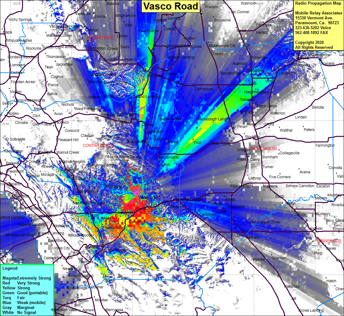 Vasco Road Coverage |
| Latitude: | 037 45 47.8N | 37.7632778 |
| Longitude: | 121 43 52.9W | -121.7313611 |
| Feet | Meters | |
| Ground Elevation: | 1099.1 | 335.0 |
| HAAT: | 449.0 | 136.9 |
| City: | Livermore | |
| County: | Alameda | |
| State: | California |
This is not an MRA Owned Site. For space rental contact the site owner.
Do you own or manage this site? Click Here
Would you like to add a site to the Google Earth Map?? Click Here
Site Coverage: Coverage of Pleasanton, Livermore, Trevarno, Ulmar, Altamont, Cayley, Midway, Mountain House, Asco, Dublin, San Ramon Village, San Ramon, Tassajara, Byron, Trull, Blackslough Landing, Tomspur, Bethel Island, Terminous, Lodi, Haight, Victor, Collierville, Acampo, New Hope Landing, Walker Landing, Five Points