Wiederman Hill
| Site Name: | Wiederman Hill | 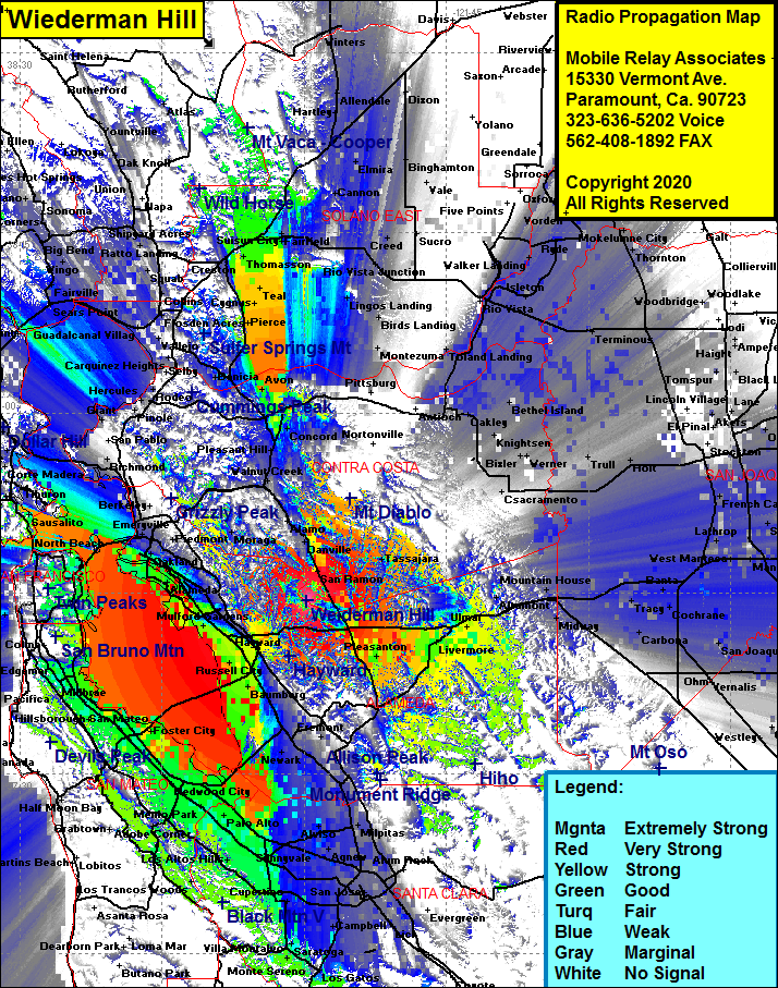 Wiederman Hill Coverage |
| Latitude: | 037 44 20.0N | 37.7388889 |
| Longitude: | 121 59 42.5W | -121.9951389 |
| Feet | Meters | |
| Ground Elevation: | 1844.0 | 562.1 |
| HAAT: | 1267.3 | 386.3 |
| City: | San Ramon | |
| County: | Contra Costa | |
| State: | California |
This is not an MRA Owned Site. For space rental contact the site owner.
Do you own or manage this site? Click Here
Would you like to add a site to the Google Earth Map?? Click Here
Site Coverage: Coverage of the San Francisco Bay area, west bay, east bay, south bay, San Ramon, Danville, Dougherty, Pleasanton, Asco, Killcare Woods, Scotts Corner, Livermore, Ulmar, Altamont, Danville, Alamo, Walnut Heights, Walnut Creek, Eastport, Valle Vista, Pierce, Cygnus, Teal, Jacksnipe, Thomasson, Subeet, Russell, Clima, Wilota, Danielson, McNears Beach, San Quentin, Alamo, Walnut Creek, Pleasant Hill, Concord, Scotts Corner, Castro Valley, Dublin