Williams Hill
| Site Name: | Williams Hill | 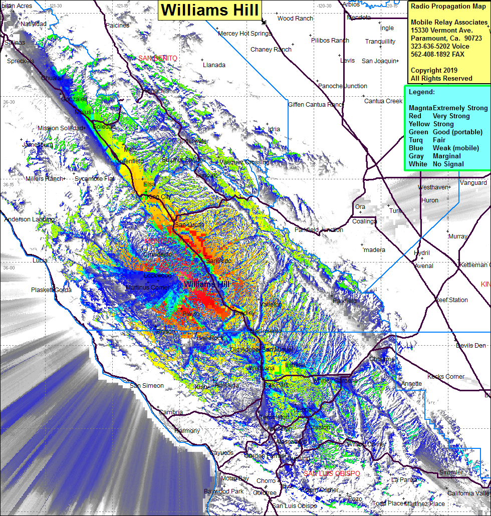 Williams Hill Coverage |
| Latitude: | 035 57 14.3N | 35.9539722 |
| Longitude: | 120 59 26.7W | -120.9907500 |
| Feet | Meters | |
| Ground Elevation: | 2668.0 | 813.2 |
| HAAT: | 1615.5 | 492.4 |
| City: | San Ardo | |
| County: | Monterey | |
| State: | California |
This is not an MRA Owned Site. For space rental contact the site owner.
Do you own or manage this site? Click Here
Would you like to add a site to the Google Earth Map?? Click Here
Site Coverage: Coverage of Highway 101 south to Oak Park and north to Salinas, Wellsona, San Miguel, Etrella, Old Adobe, Nacimiento, Bradley, Valleton, San Ardo, San Lucas, King City, Elsa, Greenfield, Metz, Soledad, Martinus Corner, Lockwood, Pleyto, Bee Rock, Bryson, Templeton, Atascadero