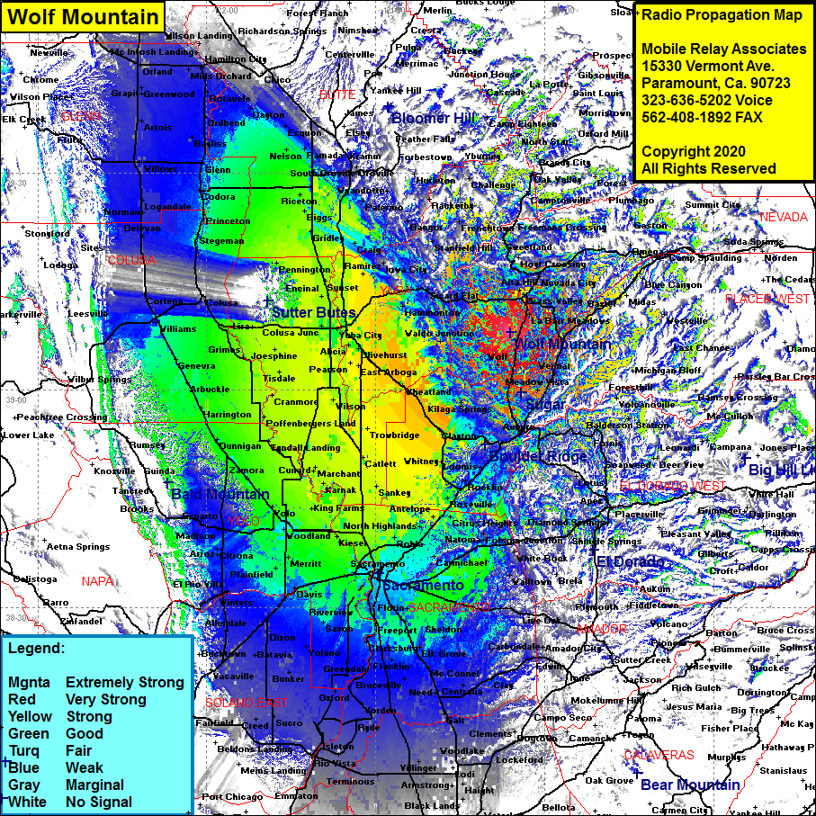
Select Page

Radio Tower Site – Wolf Mountain, Grass Valley, Nevada County, California

Wolf Mountain

Site Name: Wolf Mountain
Latitude: 039 08 00.6N 39.1335000
Longitude: 121 06 00.8W -121.1002222
Feet Meters
Ground Elevation: 2634.0 802.8
HAAT: 949.3 289.4
City: Grass Valley
County: Nevada
State: California

This is not an MRA Owned Site. For space rental contact the site owner.

Do you own or manage this site? Click Here

Would you like to add a site to the Google Earth Map?? Click Here

Site Coverage:    Coverage of the San Joaquin Valley south to Stockton and north to Kirkwood, Cherry Creek Acres, Dew Drop, Higgins Corner, Elders Corner, Casey Corner, La Barr Meadows, The Oaks, Alta Hill, Spring Hill, Grass Valley, Bitney Corner, Newtown, Town Talk, Gold Flat, Nevada City, White Spot, Sweetland, Birchville, Bridgeport, Rice Crossing, Mooney Flat, Smartville, Timbuctoo, Sicard Flat, Browns Valley, Waldo Junction, Kilaga Springs, Nielsburg, Bowman, Clipper Gap, Meadow Vista, Colfax, Alta, Baxter, Monte Vista, Gold Run, Magra, Cape Horn, Iowa Hill, Volcanoville, Yankee Jims

heat map radio coverage Wolf Mountain


0 0 votes
Article Rating
Subscribe
Notify of
guest
0 Comments
Inline Feedbacks
View all comments
0
Would love your thoughts, please comment.x
()
x