Aubrey Butte
| Site Name: | Aubrey Butte | 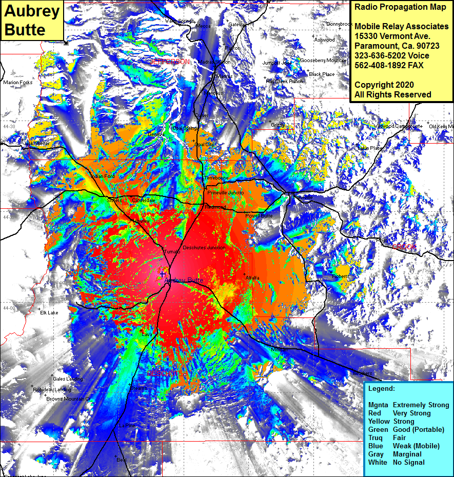 Aubrey Butte Coverage |
| Latitude: | 044 04 38.6N | 44.0773889 |
| Longitude: | 121 19 54.7W | -121.3318611 |
| Feet | Meters | |
| Ground Elevation: | 4229.0 | 1289.0 |
| HAAT: | 587.6 | 179.1 |
| City: | Bend | |
| County: | Deschutes | |
| State: | Oregon |
This is not an MRA Owned Site. For space rental contact the site owner.
Do you own or manage this site? Click Here
Would you like to add a site to the Google Earth Map?? Click Here
Site Coverage: Coverage of Tumalo, Desechutes Jct, Plainview, Sisters, Indian Ford, Cloverdale, Jack Shelter, Geneva, Opal Springs, Culver, Grizzly, Treebonne, Prineville Jct, O’Neil, Forest Crossing, Powell Butte, Alfalfa, Roberts, Millican, Brothers, Lava, Stearns, La Pine, Gales Landing, Robideau Landing, Lakin Place, Metolius, Madras, Madras Station