Bald Peter
| Site Name: | Bald Peter | 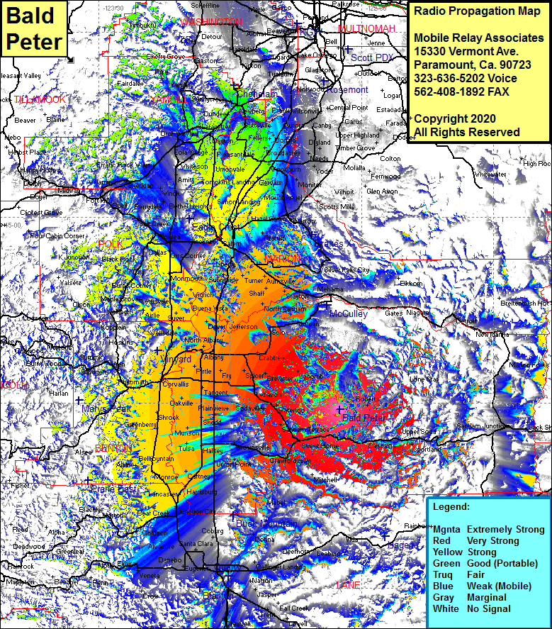 Bald Peter Coverage |
| Latitude: | 044 28 58.9N | 44.4830278 |
| Longitude: | 122 34 59.0W | -122.5830556 |
| Feet | Meters | |
| Ground Elevation: | 3795.0 | 1156.7 |
| HAAT: | 2282.2 | 695.6 |
| City: | Foster | |
| County: | Linn | |
| State: | Oregon |
This is not an MRA Owned Site. For space rental contact the site owner.
Do you own or manage this site? Click Here
Would you like to add a site to the Google Earth Map?? Click Here
Site Coverage: Coverage of Albany, Draperville, Crabtree, Griggs, Whitaker, Fords Mill, Lacomb, Roberts, Sportland, Caseadia, Sweet Hime, Greenville, Crawfordsville, Mitchell, Calapooia, Mabel, Vendling, Marcola, Donna, Lancaster, Harrisburg, Rowland, Halsey, Tulsa, Miller, Munson, Potter, Fayetteville, Shedd, Plainview, Waterloo, Sodaville, Lebanon, Tallman, Spicer, Fry, Tangent, Page, Riverside, Pirtle, Corvallis, Avery, Dry Creek, Shrock, Greenberry, Bellfountain, Bailey Jct, Glenbrook, Bear Creek, Cheshire, Goldson, Long Tom Station, Suver, Parker, Talbot, Wells Landing, Wigrich, Monmouth, Salem, Chapman Corner, Lakebrook, Clear Lake, Wheatland, Whites Landing, Waconda, Pleasantdale, Saint Paul, Ladd Hill, Donald, Hito, Aurora, Butteville