Buck Mountain
| Site Name: | Buck Mountain | 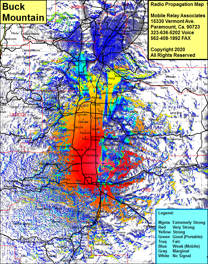 Buck Mountain Coverage |
| Latitude: | 044 11 51.9N | 44.1977500 |
| Longitude: | 122 59 11.3W | -122.9864722 |
| Feet | Meters | |
| Ground Elevation: | 3145.0 | 958.6 |
| HAAT: | 2423.9 | 738.8 |
| City: | Coburg | |
| County: | Lane | |
| State: | Oregon |
This is not an MRA Owned Site. For space rental contact the site owner.
Do you own or manage this site? Click Here
Would you like to add a site to the Google Earth Map?? Click Here
Site Coverage: Coverage of College Hill, Eugene, Danebo, Alvadore, Goldson, Swain, Junction City, Lancaster, Harrisburg, Monroe, Cartney, Fowland, Miller, Tulsa, Halsey, Potter, Peoria, Shrock, Greenberry, Dry Creek, Verdure, Plainview, Tangent, Corvallis, Philomath, Fry, Page, Albany, Millersburg, Marion, Talbot, Suver, Clow Corner, Roberts, Dallas, Judson Landing, Ellendale, Salt Creek, Perrydale, Durbin, Hayesville, Hazel Green, Lakebrook, Simon Landing, Mount Angel, Fairfield, Gervais, Dayton, Donald, Aurora, Newberg