Cabbage Hill
| Site Name: | Cabbage Hill | 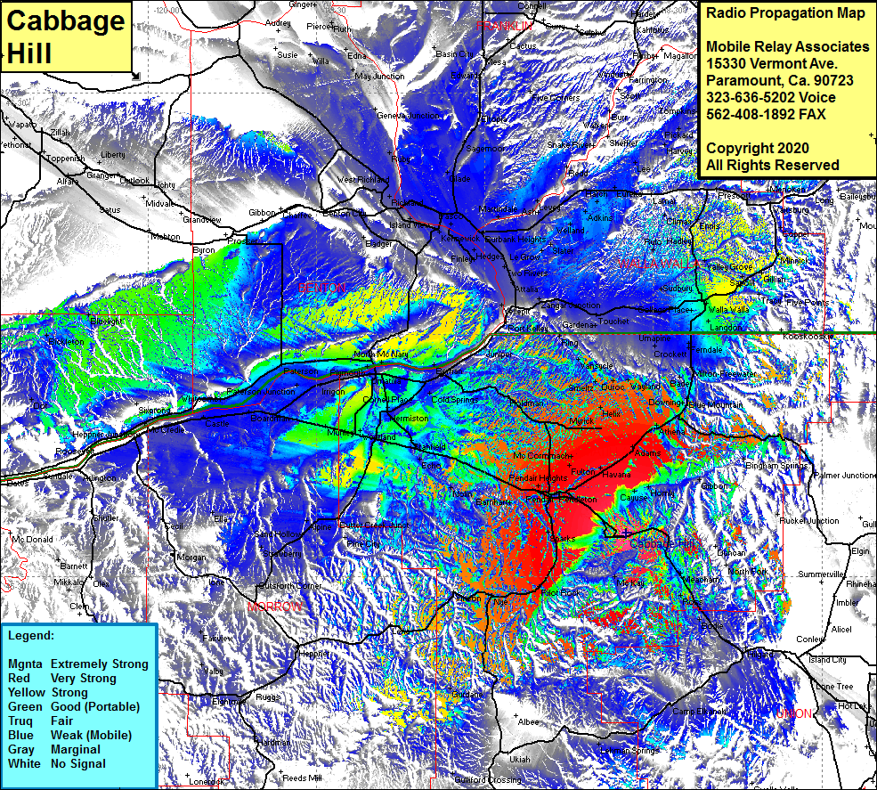 Cabbage Hill Coverage |
| Latitude: | 045 35 20.5N | 45.5890278 |
| Longitude: | 118 34 46.7W | -118.5796389 |
| Feet | Meters | |
| Ground Elevation: | 3561.0 | 1085.4 |
| HAAT: | 1059.7 | 323.0 |
| City: | Pendleton | |
| County: | Umatilla | |
| State: | Oregon |
This is not an MRA Owned Site. For space rental contact the site owner.
Do you own or manage this site? Click Here
Would you like to add a site to the Google Earth Map?? Click Here
Site Coverage: Coverage of Minthorn, Mission, Fulton, McCormmach, Midway, Blakeley, Havana, Blakeley, Myrick, Kings Corner, Helix, Apex, Smeltz, Duroc, Wayland, Stanton, Vansycle, Ring, Juniper, Cold Springs Jct, Juniper, Holdman, Pendair, Pendleton, Munra, Sparks, McBee, Rieth, Barnhart, Yoakum, Nolin, Echo, Stanfield Jct, Berrian, Juniper, Ring, Vansycle, Stanton, Duroc, Wayland, Waterman, Downing, Bade, Prunedale, Barrett, Umapine, Ferndale, Spofford, Calhounville, Langdon, Walla Walla, Garrett, Pedigo, Sudbury, Russell, Valley Grove, Harbert, Touchet, Gardena, Zangar Jct, Wallula, Two Rivers, Minnick, Coppei, Waitsburg, Milton-Freewater, Bade, Prunedale, Umapine